


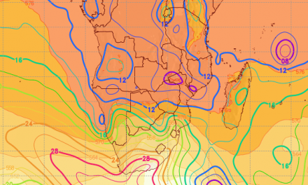
Overview for the week and 5-day outlook to Wednesday 09 May 2018
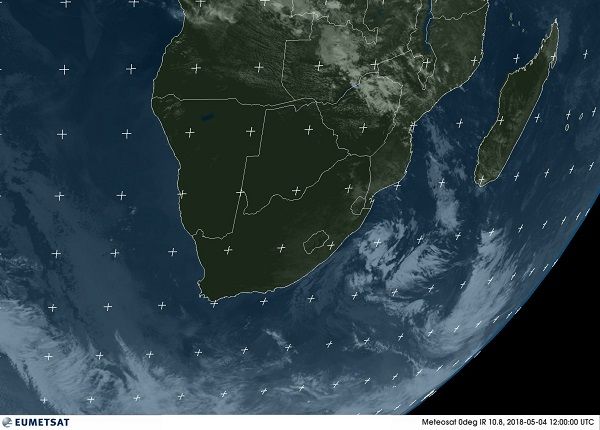
Visual: Eumetsat infrared satellite image of southern Africa at 14:00 on Friday 04 May. The colour is digital and is generated by a computer.
Source: http://oiswww.eumetsat.org/IPPS/html/MSG/IMAGERY/IR108/COLOR/SOUTHERNAFRICA/
What Happened
A fairly dull week in terms of weather on the ground but still with a few outstanding local features that developed later in the week. As can be seen readily from the satellite image, most of southern Africa was under high pressure control through all the levels of the atmosphere. The dark green areas over land and the dark blue over the ocean indicate a lack of cloud and higher temperatures than the surrounding shades of grey.
The week started with the South Atlantic high pressure cell offshore Cape Town on its customary latitude but very close to the continent. The high pushed along a weak cold front which quickly fizzled out as it moved over land. The only noticeable impact was the persistently cooler nights in Namibia in all the areas south of Etosha.
By Wednesday the high has moved across much of the subcontinent but the remnant of the cold front developed into a veritable low pressure system offshore Port Elizabeth. This system gathered strength and by Thursday had caused some solid but erratic showers over South Africa’s interior, shifting to the eastern Cape and then up the east coast to KwazuluNatal where there was much activity during Friday morning.
This may seem very far away from Namibia but closer inspection of the satellite image shows the whitish band running from northern Angola through Zambia, Zimbabwe and Mozambique into the bottom half of the Mozambican Channel. That is where the moisture went and why so little of it entered Namibian airspace.
With high pressure control over land and the strong low pressure system offshore South Africa, the east to west zonal flow from the Indian Ocean was obstructed and diverted to the south-east, skimming along the outer perimeter of the high. The result was zero rain over the very vast area that is clear (dark green) on the image. All the action was over the southern and the eastern regions of South Africa.
In Namibia a weak low pressure system was present over the northern Namib with its greatest impact on the surface. The remnant of this system can be seen on the image as a cluster of thin cloudy spots over the Kunene Region. For the rest the country was sharing its high pressure fate with the rest of southern Africa.
It was noticeable that some good cloud formations were present over large areas of Owambo and the Kavango, and that the surface was still hot north of Etosha. This is due in part to descending air as a result of the high pressure control, and to the intrusion of moist, warm air in a so-called inversion layer which originated in Zambia.
This is an intrusion into the general high pressure atmosphere but at a very specific height where temperature and air density allows this type of influx. Late in the week, cloudiness also appeared over large areas of the rest of Namibia, but in all instances, these were marked by a relatively high cloud base at around 14,000 feet and cloud tops that did not reach the 30,000 feet mark. These restrictions suppress convection and the result is zero rainfall.
The only exception was Namibia’s western escarpment from where there were several reports of drops or very light showers indicating that even weak convergence between the low on the coastal plain and the high over the interior, can produce some isolated light showers.
What’s Coming
A dry weekend for the entire country with warm to hot conditions above the escarpment. With such a prominent high pressure control of the interior, some mild oosweer may be present at the coast but only late afternoons.
A frontal system ahead of the next approaching South Atlantic high makes landfall in the Western Cape during Monday. This is a strong system and its northern extension may reach the Sperrgebiet and the Orange River Valley. If not accompanied by light rain (on the coastal plain below the escarpment), it will definitely be felt in much colder nights on Monday and Tuesday.
Conditions over the rest of Namibia will be quiet, continuing the pattern of cooler nights and warm to hot afternoons. Over the northern half, the airflow near the surface will be easterly to north-easterly which can lead to a deceptive amount of cloudiness but overall conditions are not conducive to rainfall.


