22 August 2014
![]()
What Happened?
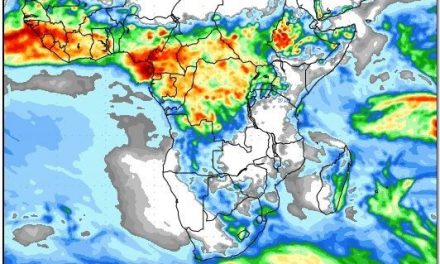
By Wednesday afternoon the outer fringe of the South Atlantic high pressure cell made landfall between Lüderitz and Sandwich Harbour. The barometric pressure this far away from the core, which still lay more than a thousand kilometres out to sea, only read 1020 mB but it was sufficiently strong to make its presence felt over the Sperrgebiet National Park, moving east during Thursday, and eventually covering most of the Karas Region. By Friday, it has made its signature rotation being driven from the south-east, and brought cooler night temperatures over the Kalahari. But that was only on the surface. At higher levels two low pressure systems reign supreme. The lower pressure north of the Angolan border (due to warmer surface conditions), and a very strong vortex just south of Cape Town, controlled the upper air respectively from the north and the south. Visualise the protruding high pressure cell as a dense, cold bubble pushing in on the surface from the Atlantic, with the low pressure systems above it, covering it completely, and diminishing much of the cold effect a high pressure cell would normally cause. Also at surface level however, the low pressure system along the northern half of the coastline, opposed the intrusion of the high pressure cell. This lead to the well-known conditions along the coast of northwinds north of Swakopmund, and of fresh westerly, and later southerly winds, south of Walvis Bay. In the upper air however, the two low pressure systems met (i.e. above more or less 16,000 feet) creating a very strong zonal flow from west to east. These so-called streamlines are the bane of airline pilots when they fly to Windhoek. But when they fly back, they knock off half an hour earlier having been carried by the upper air jet streams. The difference in wind direction is easy to observe. For example, on Wednesday, the windflow was from the west, on Thursday from the south, and on Friday from the east. But ONLY ON THE SURFACE. Were one to look up, the thin layer of cloud showed that the upper air flow was from north-west to south-east, following the convergence line which is typical for Namibia, and very typical for the season. These thin clouds moved at around 16,000 feet but since the source of the moisture is the Atlantic (cold) and not the Indian Ocean (warm), the moisture is indeed very low, and coupled with the surface effect from the ridging high, it hardly lead to any substantial rain. It is noteworthy that this feature usually only manifests later in September when very high clouds are often visible with their so-called virga rain below them, but not a drop on the ground. Virga is the Latin for old man’s beard, and it aptly describes the shape and appearance of this upper air rain.
So it may be not inappropriate to say that current conditions are about a month early, but these may revert to normal depending on the latitude of the South Atlantic high pressure cell. The paradox is that the system driver, the surface high, through convection, dissolves the moisture brought in by the low pressure trough, above it.
What’s Coming?
The after effect of the high pressure cell lingers on during the weekend moving over the Kalahari by Saturday. But already, a trough (low pressure) which started moving in from the Kunene mouth moves towards the south along the coast, and the high collapses as it moves across the sub-continent. For the weekend, the weather is again a picture of northern half, southern half. Airflow across the north is predominantly from the north, backing to the north-west towards the end of the weekend. Temperatures across the entire north, from Kunene to the Zambezi, will tend to go above 30oC every day. The Karas region will be cool during the night, but from Sunday onwards, this will also disappear as the airflow from the north-west pushes the cold air away. A relatively strong South Atlantic high is situated about four days away but the airflow from the north, should lessen its effect, again. At this very long range (4 months) the Southern Oscillation Index maintained by the Australian Bureau of Meteorology, is signalling a wet December and a very dry January 2015, not unlike the end of 1999, a year and a half after the 1998 drought.