08 August 2014
![]() What Happened?
What Happened?
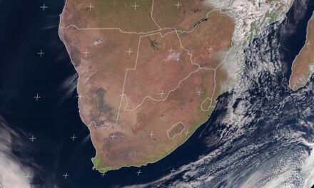
Low pressure control of both the surface and the upper air remained the dominant feature of the week. Earlier in the week, the South Atlantic high pressure cell made its presence felt south of the imaginary line running through Lüderitz and Keetmanshoop, but this intrusion was very brief due to low pressure control in the upper air. At most the presence of the high lead to very windy conditions at Oranjemund and Lüderitz as well as the Sperrgebiet, but these winds subsided as the approaching high was absorbed by the prominent low pressure system over the interior. In very simple terms, the surface winds basically blew themselves out into the upper atmosphere as they encountered the strong north to south airflow induced by the (low pressure) trough. As the high made landfall during Monday night, it was immediately opposed by the reigning low pressure conditions over the interior, collapsing in a spectacular fashion, and only remaining as a vestige wrapping the sub-continent from west to east. By Wednesday, although still strongly defined offshore from the continent, it was no match for the prominent low pressure trough moving in from the north. South of this elongated high pressure cell lay a complex series of weaker low pressure systems, all interconnected, stretching from as far north as the Angolan border to several thousand kilometres south-east of Madagascar. At one point during Thursday, this system of low pressure areas had a reach of over 8000 kilometres extending from way west of the continent to very far east. Two very noticeable features of this winter are the rapid succession of interspersed high pressure cells and low pressure vortices. The main surface feature for about the past three months, was a prominent north-south-north airflow, rapidly swinging around from south to north, sometimes in the matter of a single day. The result was that whatever cold intrusions happened from the south, these were brief and seldom lasted two days. The other feature is the prolonged low pressure control in the upper air. This is created by the extreme northern circulation of the South Indian high pressure cell, as it leans back in the upper air, exerting an influence that covers the whole continent south of the equator. We experienced it as the warmer airflow from the north that intermittently, suppressed the cold effect of the high from the south, and helped to create mild to warm conditions quickly after each cold front. When the low pressure from the north meets the opposing high pressure from the south, it creates a visible convergence line with fresh winds blowing from the north-west. Again this was very obvious on Wednesday becoming even more prominent on Thursday and Friday. This convergence line was situated right where expected, running across Namibia from Ruacana in the north-west through Aroab and Mata Mata in the south-east. West of this line, drier, cooler conditions reigned while east of this line, cloud formation and rain (over the South African interior) were observed accompanied by much warmer temperature. In this regard, note both Rundu and Ondangwa where temperature were above 30oC almost the whole week.
What’s Coming?
This Friday sees the cores of the South Atlantic high and the South Indian high situated about equidistant from the continent on either side – west and east. This results in a continuance of the low pressure control. Over the continent, the South Indian high drives the circulation in the upper air, and the South Atlantic high drives the surface winds which will remain mostly south offshore, but east onshore. This Friday night may be the last cold intrusion of this winter. Low pressure control on the surface and in the upper air, is the dominant feature of August. It is what creates the well-known windiness of the change of the seasons, and its effects extend into September when the horizon disappears in a haze of continental dust. Already by Saturday, conditions should become warm to hot, the further north one goes and next week may mark the first meteorological week of spring. The low pressure trough, in fact, will become so prominent that there is an outside chance for light rain over the Kunene region from Tuesday onwards. Given the dissipating tendency of the South Atlantic high, there is also a small chance for light rain over the desert between Lüderitz and Oranjemund.