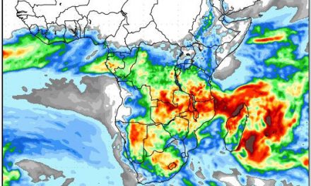
Understanding Weather – not predicting – 05 July 2013
What happened?
The most noticeable feature of current synoptic charts is that they consistently diverge from normal, expected patterns.
The implication of this departure from the expected range presents a broad scenario which can be quite difficult to interpret. The difficulty being that both interpretation and forecast models are founded in patterns that have been identified and described for over 200 years, and as such, they are unable to provided meaningful analysis of the departure from the normal range of weather synoptics.
Over the past decade it has become popular to sweep all the divergent observations into one basket, that of so-called climate change, but developing new models based on precise details, has been elusive so far. For instance, the sub-tropical high pressure belt that encircles the southern hemisphere, has shifted some 10 to 15 degress latitude further south, which in turn, has brought major changes to weather patterns further north, i.e. between the high pressure belt and the equator.
Yet some features retain a cohesive link with our previous rangesof experience. Of course it’s confusing, yet the intertwining link of the new and the previously accepted offer weather windows of major significance for ourselves here in Namibia. This last week gave yet another building block toward this.
When there is an anticyclonic core to the east, preferentially from the surface to some 8000 to 10000 feet, almost to the 700hPa-level, we experience a northerly (warm) airflow. This is an established pattern. Where divergence occurs is that this core has its surface core extending (regularly) southward outside its expected range. This gives rise to upper air troughs or individual vortex development to our west. These are not not unknown, but frequently recurring these days. This last week gave us just such a sample.
Daily warmth, tempered by overnight chill prevailed while a coastal “low” development ahead of a distant cold front barely had an effect. By Tuesday, a weak core was identified between 30oS and 35oS to the west. North-westerly airflow saw cloud development from 10000 feet above sea level, i.e. 5000 to 6000 feet above ground level during Wednesday. A prospect of showers loomed for the Kalahari, A winter rainfall expectation is normal, but not from the northwest. What the next couple of days produce can be difficult to presume. The absence of winter cold persisted.
What’s coming?
One way or another, again, anticyclonic control persists over the eastern sub-continent ensuring a north wind control: basically warmer by day, cold by night. Meanwhile an intense upper air vortex, shifts to the southeast during this Friday. Its rainfall potential is limited to our eastern and southeastern borders. As it departs, a new, equally extensive upper air trough develops above mid-Atlantic, proceeding eastward through the weekend and into the new week so maintaining the high pressure control above the subcontinental interior. The new version of winter rainfall still remains limited for much of our south.


