Weather 24 July 2015
What Happened
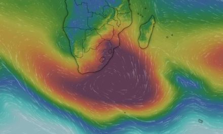
Typical winter weather patterns over the southern African sub-continent result from a delicate but very dynamic balance between two large high pressure cells, with the intermittent presence of a low pressure trough, and sometimes a vortex, between the two.
This week gave us a sterling example of just how delicate but at the same time, dynamic this interaction is. At the beginning of the week Namibia lay under a broad lower pressure trough which manifested weakly on the surface but had considerable strength from about 15,000 feet upwards. The South Atlantic high pressure cell was some distance offshore while the high pressure cell south of Madagascar was of medium strength reading some 1028mB. The two high pressure cells sat at the same latitude. It is the balance between these two cells and their relative displacement, either south or north, that created the conditions for the local low pressure middle level presence from Monday evening through Tuesday and Wednesday.
This band of lower pressure can not accurately be described as a trough as it still measures some 1016mB, very much in the high pressure zone, but relative to the two adjacent strong high pressure cells, it is an area of lower pressure.
The leading edge of the South Atlantic high acts as a conveyor belt, slowly advecting massive volumes of cold, polar air from south to north. The trailing edge of the high south of Madagascar, acts in exactly the opposite way despite the fact that both cells rotate in the same anti-cyclonic direction.
The opposing airflows encounter each other somewhere over the sub-continent, always starting in the west over Namibia, and always shifting to the east to depart the continent along the Eastern Cape / KwaZulu Natal coastline. Where these two reciprocal systems meet, a so-called convergence line is formed. Ahead of it warmer air flows from central Africa southwards usually starting in the south western corner of Namibia (Kunene) and then slowly migrating towards the east crossing Botswana and South Africa. This is the lower pressure part of the equation and it advect warmer, lighter, moister air from north to south.
Behind the convergence line follows a cold front pushed along by the leading edge of the South Atlantic high. The outer rim of this high makes landfall between Lüderitz and Port Nolloth and then continues to exert a strong influence to the north, covering the southern half of Namibia, and a lesser influence to the south.
It also shifts from west to east and as it moves, brings cold intrusions, first to the Karas Region, and as it crosses the Northern Cape, then to the Botswana interior, and finally to Namibia from the east. This rhythmic pattern is monotonously repeated during winter. Along the northern Namib coastline it causes extensive fog.
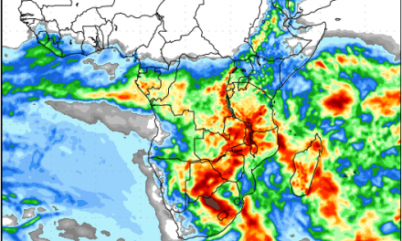
This pattern brought considerable cloudiness to the interior plateau which gradually shifted to the south eastern quadrant in the Karas Region. It brought a few intermittent drops to the Khomas, Hardap and Karas Regions, and it was followed by progressively colder nights, leading to temperatures close to or below zero in the Karas Region on Thursday night.
What’s Coming
The approaching cold front brings a major cold intrusion on Friday across the south western half of Namibia. The entire country south of Otjiwarongo has the potential for frost during Friday night. The only exception is the southern Namib below the escarpment. Saturday sees a continuation of the cold intrusion but by Saturday night it has shifted to the east with the coldest parts being along the entire length of the Botswana border from Hereroland East southward to the Kalahari and the districts north of the Orange River Valley. As the cold area migrates to the east, the dynamic balance between the two high pressure cells again creates a band of lower pressure starting at the Kunene and moving southward along the coastline up to the Kuiseb River.
The pressure differential and the opposing wind directions between the western half and the eastern half of Namibia leads to very windy and dusty conditions along the escarpment on Saturday and Sunday. By Monday the cold intrusion has moved to Botswana and mild conditions return to the Namibian interior. It will remain cold along the Botswana border but frost is not expected for next week.