


Weekly weather overview and short-term outlook to Wednesday 09 October 2019

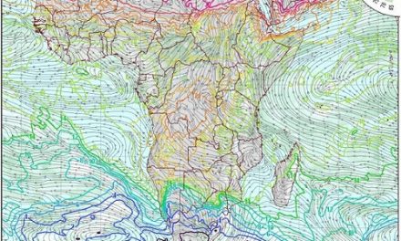
Visual: Animated sequence of southern African weather as at Friday noon.
Source: Atmospheric and Oceanic Sciences at the University of Wisconsin-Madison
https://www.ssec.wisc.edu/data/paw/clouds/eueu_soaf_clds_anim_none.gif
Recent Developments
The week started with surprisingly cooler nighttime conditions, especially given that the last of the winter months is gone. The source of this colder air was the continental high with its core located more or less over Lesotho.
From there the air was circulated in a large arch through Botswana entering Namibia from the east. The cooling effect was observed as far north as Otjiwarongo but was displaced in the northern regions by the strong anti-cyclonic circulation bringing in warmer air from Angola and Zambia.
By Wednesday, conditions have reverted to a more typical early summer stance except that the core of the South Atlantic high pressure cell is displaced to the north by some 400 km. This is not a large deviation and the core should migrate southward within the next couple of days but in the meantime its locality was close enough to Namibia to bring windy and cold conditions to the southern Namib below the escarpment.
For the remainder of the week, the continental high departed leaving the sub-continent’s interior open to lower pressures and the first vestiges of the so-called heat low that starts forming at this time of the year over northern Botswana, Western Zambia and south-eastern Angola. That obviously includes the Caprivi.
Following the departure of the continental high, the first signs of a weak mid-level low pressure band appeared but not sufficiently developed to be classified as a trough. Still, this is expected to develop into a proper trough that will form in Namibian airspace over the weekend.
The visual shows conditions around Friday lunch time. It shows the leading rim of the next approaching South Atlantic high pushing a cloud formation ahead to a well-demarcated trough off the southern Cape.
But far more interesting are the conditions over the northern half of Angola and the southern DRC. Over the past week, the Indian Ocean Transport has unexpectedly starting blowing onto the continent from the ocean north of Madagascar. This is also reflected in the standard regional synoptic charts where the isobars in the northern rim of the southern Indian high pressure cell are flat and wide apart. Depending on the position of the low pressure circulation between Kenya and India, this may be the first signs that Indian Ocean conditions may be normalising.
The visual shows a high concentration of moisture over the northern half of Angola and it is that moisture that is expected in Namibia within two days, provided the mid-level trough develops to full strength.
On the Radar
The signature summer trough from Angola through Namibia into Botswana and South Africa, is expected to start developing on Saturday, growing stronger during Sunday while maintaining a position that runs from about Outapi to the south-east through the interior and into the Kalahari.
By Sunday afternoon, a strong low pressure system will be located at the Cape. Ahead of this system the airflow is predominantly north to south. If this circulation becomes very pronounced, it will draw air from Namibian airspace and there is an outside chance that the trough in the north-east (Namibian territory) may link up with the trough over the South African interior. If that does happen, the Namibian part of the trough will remain in situ for a longer period and lead to good cloud formation in Owambo west, the Kavangos and in Bwabwata.
By Monday the leading rim of the South Atlantic high makes landfall between Port Nolloth and Oranjemund and will repeat the cold conditions prevalent earlier this week. The intrusion is however brief and will only last until Tuesday but by that time, the high’s core will be located over South Africa and the cooler air will again intrude from the east after crossing Botswana.
By Wednesday, there is a marked shift in conditions with the high having departed and lower pressure over the interior of the entire sub-continent. In the wake of the high’s departure, the normal anti-cyclonic circulation resumes and Wednesday may just bring the first significant (visible) cloud formation for the season. These clouds will come from the north-east.


