


Weekly weather overview and short-term outlook to Wednesday 27 February 2019

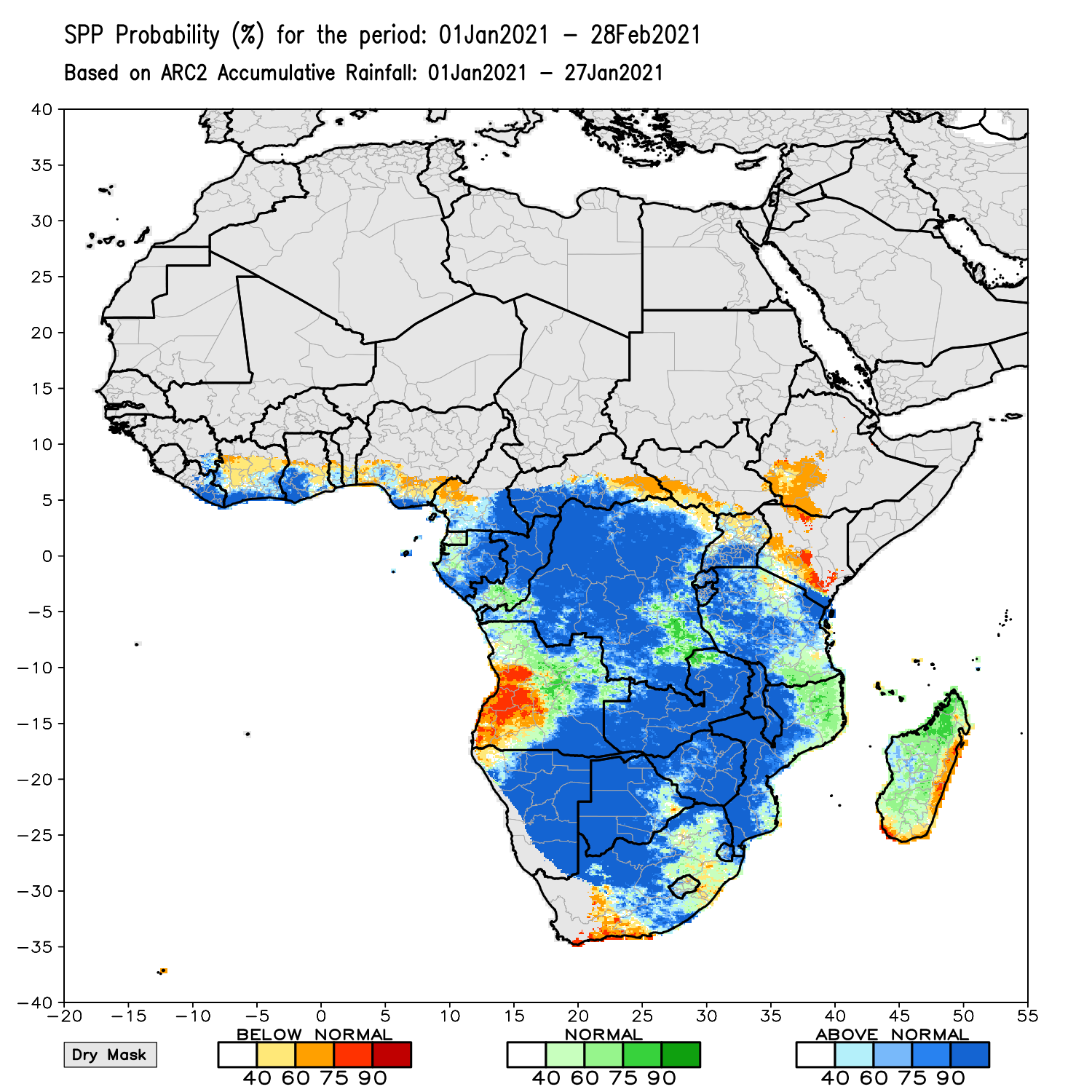
Visual: Seasonal Precipitation Probability based on first half of February rainfall.
Source: NOAA Climate Prediction Centre.
www.cpc.ncep.noaa.gov/products/international/spp/africa_arc_spp_1ic-1proj_af_sppcomb.gif
Recent Developments
This week’s visual paints a very bleak picture for Namibian rainfall up to the end of March and unfortunately it confirms the longer-term seasonal outlook published in October last year as the consensus forecast from the SADC climate division.
Events this week, and so far this month, also support the rather negative outlook.
For the duration of the week, the daily pattern replicated last week’s. It is still a matter of some high pressure control in the west and south-west, with a strong anti-cyclonic circulation over the sub-continent, pivoting around a core located roughly over southern Zimbabwe.
The visible result is a well-demarcated advection zone running from the Kavango back across the interior to the northern escarpment, from where it turns south, following the escarpment to a point south of the Kuiseb before deflecting inland again, crossing the Hardap region into the eastern parts of the Karas region.
Also similar to last week, cloud formation seems adequate but dispersed over large areas with the result that falls are very isolated, only occurring in small patches where local conditions are positive for a brief period, usually in the early evening. Relative humidity at the mid-level, around 18,000 feet, fluctuated from 25% to 45%, not sufficient even if good convection occurred in some isolated spots.
The only difference to last week is the return of somewhat milder heatwave conditions but these were restricted to the southern half and only materialised on Thursday and Friday. Heatwaves are a consequence of the thickness of the atmosphere above a given point and only occur when the so-called 500 mB surface, measured in decametres, goes above a certain minimum, usually between 588 and 591.
With so little happening on the local scene, it merits a look at conditions north of the Angolan border. The most important aspect is the location of the southern boundary of the Inter-Tropical Convergence Zone. During the second half of the austral summer, this line is typically expected to sit on the Namibian Angolan border, crossing the continent from the Atlantic Ocean in the west to the Indian Ocean in the east.
This week however, it sat about 600 km north of the border, also signalling that any moisture intrusion from the north, is unlikely to reach Namibian airspace in sufficient quantities to support cloud formation in both the middle and the upper levels.
Further afield, the Southern Oscillation Index of the Australian Bureau of Meteorology has fallen even more to a level of minus 9. Any reading below minus 7 is generally regarded as very negative for precipitation in southern Africa.

On the Radar
Overall conditions over the weekend remain poor to very poor. The Inter-Tropical Convergence Zone is located deep in Angola, too far away to have much of an impact in Namibia.
Paradoxically, the same as this week, cloud cover in the mid-levels is expected to be widespread, covering large areas of the interior. So again, it can literally rain anywhere where conditions are positive for that moment, but the falls will be highly isolated and erratic.
From Monday to Wednesday there is some movement over the northern half of the country, again accompanied by surprisingly good cloud formation, but with suppressed convection indicating a continuation of the overall negative conditions.
The South Atlantic high pressure cell has resumed its normal position east of Saldanha Bay and by Tuesday night, a weak cold front will pass within a few hundred kilometres south of Cape Agulhas. This will have an impact on the Karas region with much lower nighttime temperatures and possibly windy conditions.
For the rest of Namibia, more or less north of Mariental, daytime temperatures will be hot to very hot, with a small chance of rain from the escarpment in the west to the Botswana border in the east.


