Weather 11 November 2016
What Happened
The southern boundary of the Inter-Tropical Convergence Zone remains largely indiscernible over east Africa. In the west, across Angola and western Zambia, it is well defined indicating the presence of a fairly strong low pressure system over central Africa.
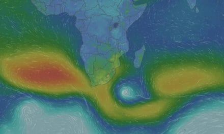
The week started with a regular synoptic pattern. Both the southern Indian and the South Atlantic high pressure cells were located in their customary positions, at more or less the usual latitude. A prominent low pressure system separated the two highs running from north to south across the subcontinent. The low pressure system was driven by the sun’s energy over land, and amplified by a strong cyclonic circulation about 1000 km south of Cape Agulhas.
This created ideal conditions for rainfall over Namibia, Botswana and central South Africa. Much moisture penetrated from Angola and with good convection over the central plateau, the average local rainfall measured around 20mm but some spectacular isolated falls were reported from both eastern and western Namibia. Some of these exceeded 60mm. As the week progressed, the synoptic pattern changed significantly. The southern Indian high weakened to an unprecedented 1016 mB while the South Atlantic high, stayed steady at 1024 mB.
With the absence of the powerful driving force from the Indian Ocean, the low pressure conditions over the sub-continent, which are typical for this early summer time, expanded enormously.
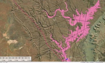
Whereas the so-called heat-low is usually concentrated over northern Botswana, western Zimbabwe, western Zambia, south-eastern Angola and north-eastern Namibia, it expanded rapidly running all the way from the western escarpment across seven countries up to northern Tanzania and coming very close to the Indian Ocean. This is an anomalous occurrence. The result was very quiet surface conditions, with only minor deviations in barometric pressure across an area of the subcontinent that covers about 3500 km by 5000 km. With such a static atmosphere, despite low pressure conditions, the airflow is very slow, but also very deliberate. By the end of the week, the effect from this could be seen in the rising humidity over central Namibia.
Until a week ago, surface relative humidity over most of Namibia was below 15%. This indicates very dry conditions at surface level. When the trough moved in over the weekend, humidity briefly rose to around 50%. By the end of this week, surface humidity remained elevated at between 40% and 50%. Higher up, relative humidity was even higher. This shows that the advection mechanism from the Indian Ocean, although obstructed over east Africa, is in place and is active.
What’s Coming
At the 500 mB surface, some 18,000 feet aloft, the northern two thirds of Namibia is quiet with only limited lateral movement. The upper air above the Karas region is however not so stable with a strong zonal flow from west to east, i.e. from the Atlantic to the Indian.
This creates positive conditions for advection from the north and the north-east for Namibia’s northern half.A prominent convergence zone develops in the mid-levels where the high pressure impact from the Atlantic Ocean meets the low pressure system from the north. The result is clear open skies west of the convergence line, with scattered clouds to the north-east. During the weekend, the central plateau is dominated by continued low pressure conditions, with higher pressure along the entire length of the coastal plain. Therefore, the interior will be quiet and hot with only limited clouds over the central area, along the Botswana border, and over the north-eastern quadrant. Rainfall prospects are limited with only isolated showers expected west of Eenhana and into the Kavango.
In the Zambezi it will be very hot once again, but the rainfall outlook here is positive. The western escarpment will be very windy from north to south, with the wind blowing mostly from the south-west and the south. Only over the northern Namib will the wind be from the north-west.