Weather 12 August 2016
What Happened
During the transition from winter to summer, the South Atlantic high remains the dominant weather driver of the region. But it is strongly opposed by the so-called continental high which is the remnant of the former South Atlantic high then residing over the eastern half of southern Africa. Since both cells are high pressure systems, they rotate in the same direction, i.e. anti-clockwise, thus where they meet, they work against each other. This often causes an inversion layer and is very typical of the intermediate phase between winter and summer.
The week gave us a classic text book example of an inversion layer. This event occurs where a high pressure system that originates over the ocean, meets and undercuts a high pressure system that sits over land. It typically happens when the continental high is exposed to more than 11 hours sunshine per day meaning there is ample time for solar irradiation. In Namibia, the outer rim of the South Atlantic high controls conditions on the surface. This can reach very far inland, usually up to about Grootfontein.
From the opposite direction, i.e. the north-east comes the circulation in the outer rim of the continental high. This is also a system dominated by higher pressure (above 1016mB) but as it crosses the surface, it heats up, becomes energized hence lighter, rises and moves in a slow circular trajectory over the high on the surface.
The high from the west, however, is a very powerful beast, its effect going aloft into the stratosphere. This we see from the so-called “thin” atmosphere and the observable value is the height of the 500mB isobar. Thus it happens that there is high pressure control on the surface (cold nights), lighter air from the north (but still above 1016mB) and high pressure control in the upper levels (around 500mB at 18,000 feet). The lighter air from the north is contained by higher pressure both below and above it.
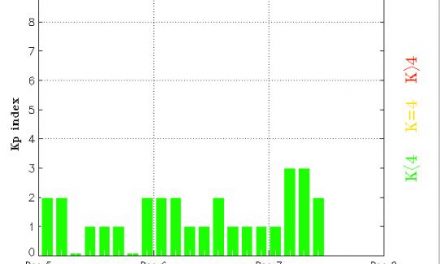
While the synoptics showed a typical late winter pattern, the inversion layer started forming on Wednesday afternoon, first over western Zambia, then into southern Angola, and from this wide front into the Zambezi and across northern Botswana. By Thursday some clouds reached as far south as Drimiopsis from where it moved to the south-east, back towards Botswana along the outer limit of the inversion layer. Inversion layers, since they are encapsulated from below and from above, are not prone to precipitation. The restrictive forces are too strong and the sunshine hours just not long and intense enough to create sufficient convection. Therefore these layers appear to pilots as broad, flat blankets of cloud that cover large areas but with very little if any turbulence. There is simply not enough energy in the system to make the air unstable. The result is almost zero vertical velocity and the blanket of cloud just sits there, slowly being turned in the direction of the anti-cyclonic rotation of the high whose core is situated much further south over the South African interior.
This cloudiness remained in the north-east until Friday by which time a weak mid-level trough has formed acting as a conveyor taking the inversion layer away to Botswana.
What’s Coming
A cold front approaches Cape Town by Friday evening. It is driven ahead of the South Atlantic high. However, it never makes landfall as there is a strong, well-developed vortex just south of the high. This vortex dissipates the high towards the south-east and the cold front slips around Cape Agulhas during the weekend.
It brings windy conditions to the southern Cape but over Namibia, surface conditions remain under control of the South Atlantic high. This should lead to colder nights, first in Karas, then more specifically the Karasburg district, and by Sunday evening, the Keetmanshoop district and the Kalahari along the Botswana border.
By Monday evening, the high pressure cell again envelops the entire subcontinent from Lüderitz in the west to Maputo in the east, but the core remains offshore. This creates space for a warmer intrusion from Angola, which by Tuesday, develops into a mid-level trough. Two leading forecasts indicate light, early rain over the interior next week Wednesday and Thursday.