Understanding Weather – Not Predicting – 25 Nov 2011
What happened?
We have seen an interesting hiatus in the development of weather patterns variously around the world as year 2011 progressed. Seasons have tended to develop late before catching up and providing “seasonable” weather. The cause for this slowed motion may not be easy to track, but the return to seasonability has been widespread. The local scene has also been part of this pattern.
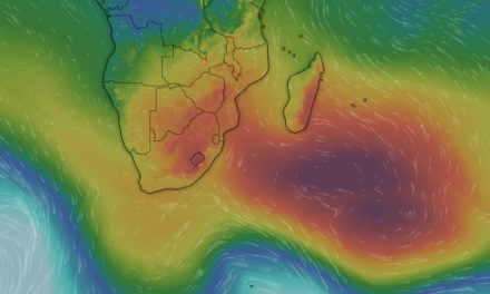
The strength of the mid-Atlantic anticyclone has been well-marked for some weeks and its lack of mobility completes the hiatus scene. There was also a visible reluctance to provide ridges, following cold fronts, of any strength around the Cape and into the Indian Ocean. Last week, this reluctance weakened to some degree and the ridging path was found more around the land-mass than partially across it, but the new anticyclonic core lacked strength.
Such an overall situation ensures a limited inflow of moist air so penetration is equally limited: a disappointing hiatus for this time of year.
But the relief from the past saw, in the course of the weekend, an inflow in the lower layers to give support to the middle level inflow’s cloud band. This increased moist advection saw afternoon convection come to fruition on Sunday and, although drifting eastward, a more usual line cumulonimbus formed from northwest to southeast across northern and eastern Namibia.
The resultant thunderstorms brought the first “summer-style” rain to many places beneath this cloud-band. Two reports noted the tropical touch which the combined airmasses could produce: measures of some 70mm for instance. Like any such storm building within such an airmass, such intensities will occur in less than an hour.
The moister air persisted across our north-east where it can truly be noted that the rainy season 2012 has got underway.
The country to the west remained in the grip of the colder flows on the east of the Atlantic anticyclone, but the upper vortex above the eastern Atlantic did bring showers to the far southwest before giving way to the colder inflows.
What’s coming?
As the new week dawns, a more seasonable pattern takes shape. A stronger ridge extends around the Cape and, after the weekend, establishes itself with expected core pressures around the 1030hPa mark.
Although the projected wind-flows do not appear very positive, the presence of such a stronger anticyclone, surviving beyond the outlook period, bodes well for the ability to supply moist air across eastern and mid-subcontinent.
The middle layers show no major change from the currently moister pattern: advection from the north-west prevails.
For the first few days, thundery showers are on the weekend menu for the Kavango valley and the Caprivi with some prospect of occasional development further west. After weekend, the shower band should be pushed further west and south into the central and southeastern areas. Shower intensities may be limited, but with an increasing advection of Congo air, falls in the 50 to 70mm range become feasible.