Understanding weather – not predicting 08 November 2013
 What happened?
The continued cool mornings is an indication of the strong influence the Atlantic high pressure cell exerts over our weather, even into normally hot months such as November. A fairly complex set of synoptics reigned this week, dominated by airflow (cold) from the southwest. Midday heat played its part, assisted by a trough (low pressure extension) reaching the interior from Angola, but cloud formation was mostly sporadic.
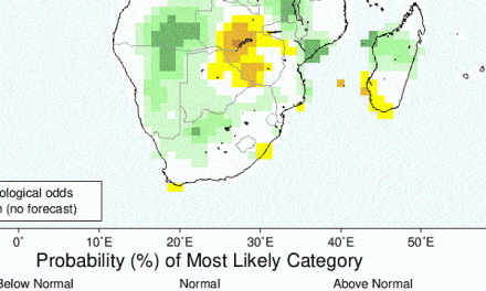
By Monday, the patterns had latched onto the upper northwesterly flow persisting across northern Namibia, drawing this rather shallow flow toward the cut-off vortex (feeding and building it all the more) from sources wider than the continental air-mass so that the broad effect of this airflow covered Namibia’s airspace in-full: not an experience frequently found! The result was a broad, but still shallow, middle cloud band offering as much as 80% cloud cover across the country which is equally rare. This cloud band carried some thunderstorm prospects and by midweek light precipitation was observed from Katima Mulilo to Oranjemund and many places in-between. Rain in the Caprivi and in Oranjemund in the same week is an extraordinary occurrence.
Meanwhile showery ability persisted for the extreme northeast and, while the airflow and the vortex moved during Wednesday, the moist presence remained above the Zambezi catchment.
As interesting and unusual as all this may be, the other factor which evolved emphasized the ready ability for a moderately favourable pattern (throughout the lower and middle layers) to become overtly active in advecting moist air into and across Namibia.
The cooler flow which spread briefly across much of Namibia was part of the drive leading to the more summer-style weather of the new week.
Rain for the week in mm
Katima Mulilo 8.2, Mpacha Airport 6.6, Bagani 6.3, Okongo 7.6, Eenhana 5.8, Grootfontein 1.2, Tsumeb 0.3, Windhoek HQ 0.0 (drops), Rehoboth 0.9, Mariental 2.2, Aranos 2.1, Aroab 2.5, Oranjemund 0.8, Nkurenkuru 4.3, and Karasburg 0.1 (Rainfall figures provided by Namibia Meteorological Service on a daily basis. See www.meteona.com)
What’s coming?
The current vortex is gone by Friday. Anticyclonic influence seems limited so allowing daytime heat to have an enlarged effect. Summer heat and surface low pressure over the interior work together to draw in a moist but thin layer of air from Angola.
This should lead to some convection over the Caprivi and the Okavango with progressively less impact further south over the central parts.
The advected airmass, however, remains too shallow to produce any typical summer thunderstorms of meaningful intensity. Scattered showers of around 5mm or less should occur from Wednesday onwards northeast of the convergence line roughly running from Ruacana to Mata Mata.