Weather 09 September 2016
What Happened
The Southern Oscillation Index maintained by the Australian Bureau of Meteorology this week went above 7 index points for the first time since June 2014. This index has hovered in positive territory since early June and has remained positive since albeit with some erratic movement. Broadly speaking, a positive SOI is an indication of La Nina conditions and if the nascent La Nina develops into a stronger cold phase in the Pacific, the SOI will increase to around 12 index points. If the La Nina becomes as strong as some models indicate, it will go above 20. All of this, however, is still some months into the future.
The see saw season is with us. While the synoptic map showed a typical late-winter pattern, there are some seasonal anomalies with a minor impact on local weather. The first to watch is the sea surface temperatures off the Patagonian coastline. It may be asked, what does the sea near South America has to do with weather in southern Africa, and the answer is, a lot. The offshore triangle between Patagonia, Tierra del Fuego and the nearby Antarctic rim, is the birth place of the South Atlantic high pressure cell. This week saw a particularly violent birth with an intense high measuring some 1040mB. As the week progressed, it started on its eastward journey across the Atlantic towards Africa. By Thursday it was about 2000km west of Cape Town, somewhat less intense at its core (1032 mB), and displaced relatively far to the south, at 41°S. Its outer rim (1020 mB) lay a few hundred kilometres offshore from Walvis Bay, while the 1016 mB isobar moved across the western half of Namibia.
This brought cold and wet conditions to the southern and central Namib which is typical winter. The anomaly lies in the strength of the South Atlantic high and in its southward displacement. The strength is indicative of a winter pattern while its position is more typically a summer pattern. Despite remaining offshore, its strength was still sufficient to bring cooler nights to the interior, and outright cold nights to the Karas region.
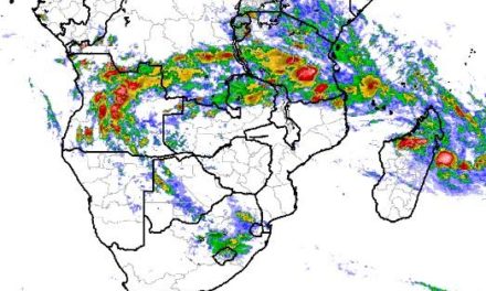
But as soon as the sun rises, the energy increases and the high is opposed from the north-east by the low pressure system over the Kavangos and the Zambezi. Again, where the high from the south-west and the low from the north-east met, a prominent convergence zone formed witnessed by ample cloud cover over the interior earlier in the week, shifting to the Keetmanshoop and Karasburg districts in the south-east. Ahead of the convergence line, airflow is from the north, while behind it, the wind (and the cold) comes from the south.
This week was the third time since mid-winter that this pattern repeated and all indications are that next week will be the same. By the end of the week, the South Atlantic high’s core has shifted to a position due south of Cape Town. Conditions over Namibia are rather static.
What’s Coming
The weekend starts with the South Atlantic high now enveloping the entire southern Africa. It lies in the shape of a kidney with high pressure conditions from Lüderitz to Maputo but it remains offshore. In the inner curvature of the kidney, a continental low pressure system forms, driven by a weak but constant airflow from the warmer tropical northern regions. This leads to hot conditions over the Namibian interior with very hot afternoon temperatures over both West and East Kavango, and over the Zambezi.
This low pressure system extends deep into South Africa’s interior, so the Kalahari also gets hot with the most intense heat where the Namibian, South African and Botswana borders meet in the Gemsbok Park.
By Monday, the high pressure cell lies south of Madagascar on its journey to become the next southern Indian high. A weak mid-level trough forms over Namibia from the Kunene to the Kalahari as is customary. The north-eastern quadrant will be hot to very hot while the rest of the interior will be quiet and hot. The next South Atlantic high will only make landfall by the end of next week.