Weather 29 July 2016
What Happened
A most unusual weather week. It started with the presence of a well-demarcated high pressure cell lying like a kidney just south of the continent. This was the former South Altantic high as it migrated around the southern tip of Africa. Nothing unusual, it should protect the mainland from a direct blast from the south.
Then, however, a low pressure system developed over the interior. This was not nearly a vortex, still measuring some 1016 mB, thus on the higher side. But in the meantime, the kidney-shaped high south of the continent has developed into a monster with a core reading of 1040mB. This is intense and the coldest oceanic temperature so far this winter. It also remained stuck for several days.
Also, early this week, most of the sub-continent crossed the 11-hour daily sunshine threshold, the energy of which helped the developing of the low pressure conditions over the mainland. The result was an enormous pressure differential – 1016 over the land versus 1040 over the ocean.
These two systems met and converged along a very long curved line stretching more or less from Oranjemund on the western shore to Maputo on the eastern shore. The high “hugged” the continent as it were, and within the inside curvature, the low pressure system nestled over the mainland. Where the high and low met, the anti-cyclonic circulation of the high merged with the clock-wise circulation of the low and the convergence was much amplified. The low’s rotation grew in strength, causing the familiar southeaster conditions at Cape Town, with gale force winds along the southern Cape and the Kwazulu Natal coastline. It also lead to some spectacular weather.
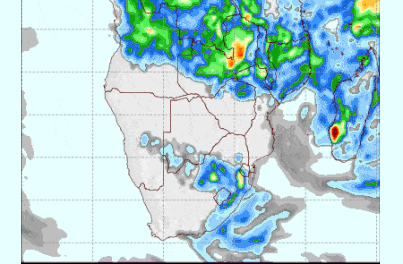
The low had its core more or less over the central part of South Africa, strongly rotating clockwise. This created the extraordinary situation where the trough that normally forms on the continent’s western coastline, this week formed over Mozambique, Zimbabwe and the eastern half of South Africa. Due to the low’s rotation, the trough then curved around the SA coastline like the outer rim of a giant wheel. This circulated moist air into the South African interior from the north taking it in a large circle around South Africa and back up the western coastline. This circulation even reached the Orange River valley with some cloudiness between Oranjemund and Rosh Pinah.But this same spinning engine also brought in the cold, dense air of the high, taking it in a wide curve north along the west coast and spilling it into Namibia from the south west. This mechanism brought in the intense cold affecting the whole country up to the Etosha latitude. By Wednesday, the high budged slightly shifting to a position south of the Mozambican Channel but the circulation over the continent continued, until Thursday which meant Namibia south and east of Etosha remained icy cold at night.
It was only during Thursday that the system has moved far enough to the east to allow for the warmer Angolan air to enter Namibian space again from the north-west.
By Friday, conditions have normalised. The southern Indian high lay south of Madagascar, the next South Atlantic high was still far out over the ocean and a weak band of lower pressure has developed between the two, covering much of the Namibian interior from north to south.
What’s Coming
The weekend starts with a low pressure vortex south of Madagascar, a mild high pressure cell south of Cape Agulhas and the next South Atlantic high some 3000km away. Lower pressures reign over the Namibian and Botswana interior leading to pleasant days.
As from Monday, a more typical winter pattern is expected with higher pressure in the east and lower pressure in the west of the sub-continent. A weak trough forms along the coastal plain, bringing in warmth from the north while the high in the east forms its customary ridge into Botswana. The eastern half of Namibia will therefore remain cold by night.
By Tuesday next week, the South Atlantic high makes landfall in the south, bringing temperatures in Karas and Hardap down but it will be brief as the high quickly slips around the continent.