Weather 26 June 2015
![]() What Happened
What Happened
The synoptic pattern at the beginning of the week presented a fairly standard mid-winter picture. The dominant South Atlantic high pressure cell lay some distance offshore with its core at the Saldanha Bay latitude.
This is its normal position. Over the eastern half of southern Africa lay a strong high pressure cell, causing a pronounced easterly airflow over the Zambezi backing to north-easterly over the northern half of Namibia.
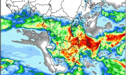
But the most active feature was the strong vortex south of Cape Agulhas. This low pressure area covered more than 2000 km across and it remained in place Monday, Tuesday and Wednesday. Its immediate effect is on the surface where it created windy wet conditions over the southern ocean, but its secondary effect is in the upper air, above 35,000 feet where it causes a strong zonal airflow, from west to east, over the sub-continent.
Whereas one would have expected a pronounced airflow from south to north, on the leading edge of the approaching high, the upper level effect of the vortex, drastically diminishes the power of the high. In Namibia it means the cold nights are short-lived and the daytime temperature quickly improves to the low twenties. Coupled with a strong anti-cyclonic circulation with its axis over central Mozambique, it amplifies the zonal flow, rapidly whisking the cold intrusion to the east.
On the surface however, conditions are very much in control of the South Atlantic high. It made landfall on Tuesday evening, dropping temperatures in the southern Namib and across the Karas Region. By Wednesday the south was noticeably colder and by Thursday and Friday, cloudy conditions appeared from the central Namib in a band stretching to the south-east up to the Orange River valley. This broad swathe of cloudiness was not a proper trough (low pressure band) but it was an area of lower pressure relative to the South Atlantic high in the south, and the high over eastern South Africa. It did however lead to some light rainy activity but the core of this activity only materialised over the southern Kalahari and the Northern Cape.
By Friday, the cold has shifted to the east, also affecting the south-eastern quadrant with limited cloudiness. This appearance was a typical northern extension of the winter rainfall area of the Western Cape, only this week it extended somewhat further north than usual.
The presence of the South Atlantic high over the southern Namib divided the country into two halves along a line running more or less from Terrace Bay through Kalkveld, Hochveld and Gobabis. South-west of this line, nighttime temperatures went down to just above zero while daytime temperatures barely reaches the lower twenties. North-east of this line, nighttime temperatures hovered around 10oC while the days became pleasant at around 24oC.
What’s Coming
Generally, a colder weekend is expected especially over the Karas Region particularly along the border with the Gemsbok Park.
There is certainly a good chance of frost over the central plateau, reaching areas further north on the western side in close proximity of the escarpment, and in the east, as far north as Bushmanland. It is not expected to go below zero before the early hours of the morning, so the duration below zero should be brief, typically less than one hour, in the hour just before sunrise. Black frost is unlikely.
As the departing high settles over the inland plateau in South Africa, local weather conditions revert to the typical cold intrusion from the east as the airflow crosses the flat Kalahari basin. Early morning temperatures along the Botswana border will be close to or marginally below zero on Saturday and Sunday.
The synoptic feature to watch is still some 5000 km out to sea and should reach Namibia by the end of next week. For the first time this winter, there are two distinct South Atlantic high pressure cells, one crossing southern Africa while the other is hugging the South American coastline. Between these to highs is a cold front running all the way from the antarctic circle northward to the Kunene latitude. It remains to be seen but this cold front has all the potential (currently) of blasting Namibia with its typical first week of July severe cold.