


Weather overview and short-term outlook to Wednesday 07 April 2021
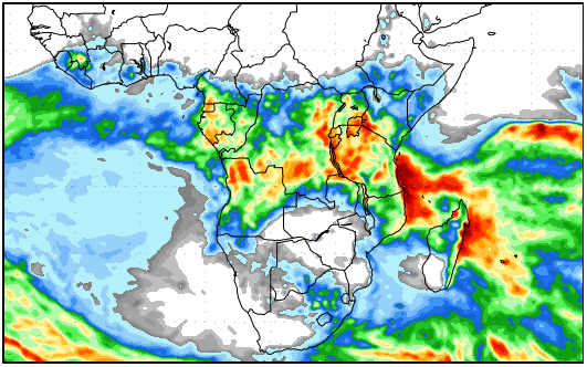
Visual: Precipitation forecast for Sub-Sahara Africa for the period 01 to 09 April.
Source: GrADS/COLA at George Mason University, http://www.wxmaps.org/outlooks.php
Recent Developments
The past three weeks demonstrated how important the mid-level trough is for local weather. This low-pressure channel is a regular summer feature, running between 15,000 and 25,000 feet from Angola’s south through Namibia into southern Botswana and from there to South Africa.
It is essentially a massive conveyor system, advecting moisture from the warmer tropical areas to the southern temperate regions. If the mid-level trough is absent, cloud formation does not happen and we do not get rain. If it is active as it is supposed to be in summer, cloud formation is extensive and rain occurs, usually over the interior above the escarpment.
But the mid-level trough’s position is not static. It shifts all the time from west to east and sometimes vice versa depending on the strength and relative positions of the two major systems that drive it, one on its western side and the other on its eastern side.
The first system, the one west of the trough, is the South Atlantic high pressure cell. If this cell is far offshore, the mid-level trough tends to favour Namibia’s west. It will then run from Angola’s south-western corner entering Namibia more or less over Ruacana and run straight through the country into South Africa’s Northern Cape province. This is when the rainfall bias is over the western half of the country.
As the South Atlantic high moves closer to shore, it pushed the trough to the east. Then it usually enters Namibia over the Ohangwena region and departs between Buitepos and Aminuis into Botswana. This is when the rainfall bias is over the Kavango and the Kalahari areas. We have seen this multiple times during the past three months.
On the trough’s eastern side is the so-called subcontinental anti-cyclonic circulation. This is also a regular feature of the whole of southern Africa’s weather and its northern perimeter is what brings warm, moist tropical air into the subcontinent’s interior including Namibia.
Since the high moves in from the south-west and the anti-cyclonic circulation from the north-east, it means the two systems have to meet somewhere and most of the time it is over Namibia. The result of this system clash is the mid-level trough and it always runs from north to south.
What we have seen lately is a very active trough but its effect was moderated on the surface level by the persistent presence of the South Atlantic high pressure cell. Visually, we observed it in the cool mornings (air from the south) while overhead there was ample cloud (air from the north).
The implication for us is that the rain season, although past its summer peak, still has some life in it and as long as current conditions remain stable, there is still a small expectation of rainfall albeit only isolated showers.
This past week, the core of the South Atlantic high was situated about 1000 km offshare and it quickly moved southwards as it started to migrate around the continent. This created ample space for a well-demarcated, strong mid-level trough, situated so far to the west that by Thursday it covered most of the coastal plane from the Kunene in the north to the Orange in the south.
With such low pressure conditions over the coastal plain and somewhat higher pressures over the Botswana interior, it sets us up for another phenomenon that is very local but usually restricted to winter – Oosweer. There is a good chance that the central coast will see some mild Oosweer over the Easter weekend while rainy conditions may be present along the entire length of the escarpment.
On the Radar
For the next few days, the rain bias is firmly in the north-west from around Outapi westwards to the Kunene Mouth.
By Sunday, this activity has more or less played out and the rainbearing system moves to the interior. With a persistent northerly airflow, cloud formation should be widespread over the interior but thin.
For Monday, Tuesday and Wednesday, there is reasonable chance of light rain over most of Namibia south of Etosha. This includes the Hardap and Karas regions but the southern Namib and the western sections of the two southern regions are excluded.
The south-western quadrant will experience considerably cooler nights from Good Friday until Tuesday next week.


