


Weather overview and short-term outlook to Wednesday 26 August 2020
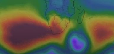
Visual: Stylised pressure map of southern Africa on Wednesday 19 August
Source. https://www.windy.com/?-22.567,17.085,5
Recent Developments
This week’s cold intrusion caught all forecasters somewhat unawares as it was not until Tuesday that the South Atlantic high pressure cell revealed its true core strength at a very respectable 1028 mB. This is not such a high reading but given where we are in the season (late winter), it is strong.
The cold intrusion was a classic adiabatic event, meaning the cold was a result of the high’s core temperature and not Antarctic air advected by its leading rim. In short, the high was already very cold when it made landfall and it spread this cold over South Africa, Zimbabwe and Botswana and from there into Namibia. Were it a diabatic event (cold air from the Antarctic), it would have been far more severe.
The visual shows very nicely the strong South Atlantic high and how deep it penetrated the sub-continent, all the while maintaining its core strength. This sustained strength brought widespread snowfall to the areas in South Africa in close proximity to the eastern and southern escarpment.
Perhaps the biggest pointer we should note is that icicles formed in many higher elevations in Namibia where temperatures dropped below zero for a few hours. Ice can only form when there is water or vapour present, indicating that relative humidity was sufficient for condensation to take place, even to the point where ice occurred.
It has been observed over the past three months that humidity close to ground level was generally higher than what is typical for Namibia. On many days, relative humidity went as high as 25% during the night while a more typical value, especially over the interior, is between 7% and 10%.
Another aspect demonstrated by this week was the stark difference in conditions over the northern parts compared to the south and the central plateau. Although the cold air penetrated Namibian airspace as far north as Rundu on Wednesday night, for most of the period before and after the cold spell, it was noticeable that the areas north of Etosha and the north-eastern quadrant, hardly went below 10°C at night and reached around 29°C late in the afternoon.
The intermittent recurring of strong cold spells is a good sign for the summer season. It shows that the high pressure cells in both the Atlantic and the Indian Ocean are very active, and that we can expect equally strong northerly airflows after the passing of each high pressure cell.
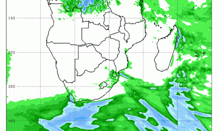
On the Radar
Temperatures quickly return to normal over the weekend and it is unlikely that nighttime temperatures will go below 5°C, even in the south.
Although proper Oosweer is not expected, coastal temperatures will also be higher due to the return of an easterly airflow.
For the rest of next week, the South Atlantic high remains far offshore with lower barometric pressures over most of the southern African sub-continent. This may lead to windy conditions in some areas (for instance along the Namibian escarpment) but these will be localised and should fizzle out once the sun rises.
The feature to watch for the next four week is the position of the southern boundary of the Inter-tropical Convergence Zone. Currently it is just north of the Angolan DRC border but should start moving south within the month.
Tracking its progression will tell us a lot of what the summer rain season will look like.


