Understanding Weather – not predicting – 19 July 2013
What happened?
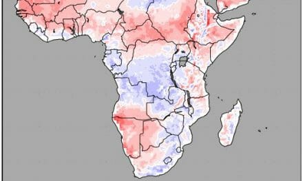
Our exposure to winter’s cold has been generally restricted. For much of the country, daytime temperatures consistently reached the middle twenties through most of the winter so far. Even cold spells that covered the south, failed to produce severe frost.
The by-now regular pattern of one cold day followed by three to four mild days, repeated itself this week. A week cold front passed the Cape early in the week bringing some brief cold air from the south west and turning the southern half of the country into a fridge, but only briefly. By Tuesday this system has migrated to the east, the windflow returned to north, north-west and milder day temperatures ensured a pleasant rest of the week.
This weather pattern has been dominated by an upper air anticyclonic presence of varying strengths but still in control providing an air flow from a northerly direction across at least the central and southern parts while keeping the northern interior with an easterly flow. Both of these synopses match the upper air presence above the sub-continent eastward of Namibia. Quite correctly, this synoptic description matches what one expects to find at this time of year.
So why the absence of colder input?
Southwards, we have a recurrent low pressure area to be found at Cape Town latitudes and active deep into the upper air. Anticyclonic presence, shallow and mobile, has kept this synoptic range in place blocking any material input of cold air further north than the Western Cape coast.
What’s coming?
This same overall control persists with scant variation for yet another week. The current vortex on the Cape Peninsula is kept in tandem with the shallow, strong pressure core system current along the 40oS latitudes. Some diffusion occurs so that by the new week these are to be found east of the continent, only to be replaced by similarly placed systems to south and west.
Elsewhere in the world, the equatorial Pacific sea-surface temperatures show some warming (back to normal ranges) but within the neutral state.
Across considerable areas, synopses note patterns similar to those adjacent to our shores with anticyclones and their ridges maintaining a north-south orientation and inflows from south to north across the middle latitudes. The whole synoptic pattern is at variance with the text book ranges of description: hence our local synopsis keeps to the international track.
Winter showers remain unlikely in our southern districts.


