


The Week’s Weather up to Friday 10 February Five-day outlook to Wednesday 15 February
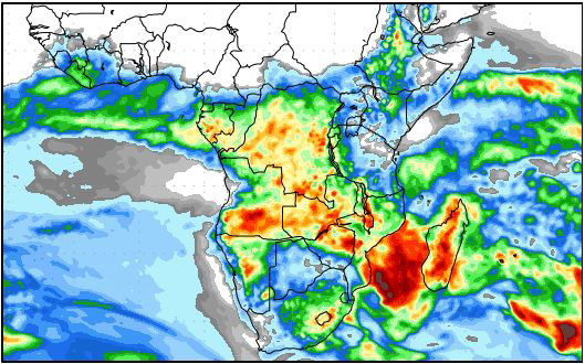
Precipitation forecast from Friday 10 February to Saturday 18 February 2017.
Source: wxmaps.org, GrADS/COLA
Tropical storm Carlos east of Madagascar has produced the expected results. Described by meteorologists as a severe storm, its windspeed was recorded at 55 knots about 100km away from the eye.
A tropical storm is an intense depression, creating a vortex that may reach as high as 24,000 feet. This mechanism acts like a suction pump or a vacuum cleaner on a massive scale. It carries immeasureable amounts of water vapour aloft leading to a very high so-called vapour load. This is a condition where actual humidity approaches 100%, as opposed to relative humidity that depends on pressure and temperature.
In the upper atmospheric levels, the vapour load stretches out over an area that may have a radius of 1000km or more. With this much vapour in the air at such high altitudes, all it requires is a so-called transport to take it from east of Madagascar into central and southern Africa.
This transport, or in this week’s case, two transports, were provided by the Inter-Tropical Convergence Zone, and by the northern rim of the high pressure system over the eastern parts of South Africa and the southern half of the Mozambican Channel.
Two distinct transport channels became visible on upper atmosphere maps. At the 500 mB surface, the effect of the combination of a zonal airflow from east to west, coupled with the high vapour load, produced a continuous string of small low pressure areas, all interconnected in one long channel stretching from the northern tip of Madagascar, across Mozambique and Zimbabwe into Zambia and Angola. This was an almost straight line channel feeding directly into the Namibian atmosphere from Zambia. It caused elevated moisture levels from about 12,000 feet upwards.
For the duration of the week, it was very active and while Carlos remained within about 1000 km from the Madagascar coastline, it did its magic.
Meanwhile, furhter south on the southern perimetre of Carlos, a secondary, slightly weaker channel developed, crossing the Mozambican Channel and entering the continent at the Mozambican KwazulaNatal border. This line ran through South Africa’s Limpopo Province and from there through Botswana into Namibian airspace south of Buitepos. Although much weaker, it amplified the resident moisture that had entered Namibia from Zambia.
In southern Angola, a cyclonic circulation on the surface helped advecting air from central Angola in a wide arch across Bwabwata and Kavango East into the Namibian interior. The result was a dramatic three-level weather system straddling the Namibian Angolan border, slowly migrating towards the west, bringing some spectacular rainfall to the Kavango, Owambo and lesser falls to the Kaokoveld.
During the week, this three-layer system grew in strength, slowly migrating from the north-east to the south-west. By the end of the week it covered the entire Namibia, even pushing deep into the southern Namib.
A relatively weak South Atlantic high pressure cell assisted this process by remaining far offshore. At one point during this week, on Thurday, the westwards movement of the wet intrusion, progressed so far that it moved into the Atlantic for more than a hundred kilometres. This created some unique, stormy weather along the coast from Walvis Bay northward.
What’s Coming
Tropical storm Carlos slips away into the southern Indian Ocean at the rate of about 5 knots. During the weekend it has moved too far to continue having such a dramatic effect on Namibian weather.
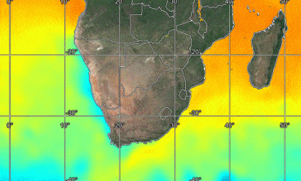
The South Atlantic high pressure cell becomes stronger with an expected core reading of 1028mB but it remains offshore. As its leading edge migrates around Cape Agulhas, only the southern half of South Africa is affected, and only on the surface. This impact is restricted to south of the Orange River.
Over the rest of the sub-continent, low pressure conditions remain in place. The north-east airflow continues with much moisture intrusion.
By Monday, a low pressure system starts forming in the Mozambican Channel. Some forecasts see this system dissapate but at least two leading forecasts expect it to grow into a mild tropical storm by Wednesday. If this happens, a repeat of the same positive rainfall conditions is on the horizon.
Rainfall conditions over Namibia remain positive up to Wednesday except for the southern Namib and the Karas Region.


