Understanding Weather – not predicting – 21 March 2013
What happened?
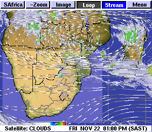
For yet another week, weather’s patterns marched to differing beats at the same time, responding to a varied range of relevant, but conflicting, sources. The bottom line meant that while a rainy promise could loom, reality as a daily occurrence would not be fulfilled.
Distant promises of moist air intrusion could not be ignored as such presence was close by. Either moisture in the alto levels was present close to our borders, or the advection system needed only a few more hours to bring in substantial quantities of moist air. It did not happen despite the frequent cloud covering large parts of the interior and even the escarpment in the southwest.
Moist air presence saw intermittent showers recur along our northern borders. Occasionally a limited spread southward gave promise for an intrusion to bring a deeper airflow into and extend further south, but just as quickly as it appeared so did the unfavourable pattern restore its control.
Upper air charts persisted with a 10,000 foot depth of an anticyclonic core extending from our skies westward across the South Atlantic. Its latitude dominance holding sway between 25 and 35oS. Its altitudes being from some 16,000 feet through to some 27 or 28,000 feet then merging with the activities of the jet-stream altitudes which are found from the 30,000 foot heights upward of the 40,000 levels.
Such heights are too lofty for convective penetration to have any effect when above land, let alone such disturbance above an ocean, while also being too far north for frontal disturbance resulting from a similarly intense (altitude extent) upper air trough to disturb the west to east flow marking the inner core of the anticyclone. Again these conditions continued for yet another week.
March is the final of the really wet months. So far this March has, for all but the northern border areas, been among the driest. The northern border areas recorded occasional moderate showers, Omuthiya’s 24mm leads the daily value. Other measures were scarcely above the decimal point value. Elsewhere, rain was virtually non-existent. The core of the upper air pressure system moved across southern Namibia during this last week.
What’s coming?
As the weekend approaches, a well-marked trough and cold front approach and pass the Cape,. There seems to be a squeeze exerted on the anticyclonic core as it drifts further east and, at the same time, enables a moist inflow to advance from Angola across the northern areas spreading across a broadening area of Namibia. For once the outlooks agree with a continuance of this more favourable advection through the weekend into the new week. Rainfall prospects are limited as the upper dry airmass does weaken but not, at this stage, fade completely. The resultant lower level moist air spread can reach all but the most westerly parts.
What we are seeing is an aborted version of a more regular pattern establishing an influence. Whether this can become better established is still uncertain. The controlling complexities are still at odds.