


Weather 10 June 2016

What Happened
The eastern half of southern Africa was generally much cooler than the western half for the duration of the week. The high pressure system over South Africa, which has been stuck there since the previous weekend, controlled surface conditions. During this week, its grip on the region’s weather grew eventually covering most of South Africa, Zimbabwe, Botswana and even southern Mozambique.
This high was reluctant to depart the continent despite a very active and volatile bigger synoptic picture. Its trailing (western edge) formed a so-called ridge which split Namibia nicely into two halves, north-eastern and south-western. In the north-eastern quadrant, colder, stable conditions were present while in the western and southern regions, a mid-level trough developed behind the ridge, creating space for advection of warmer, moist air from Angola, through Namibia’s western half and on into the Northern Cape.
By nature of the anti-clockwise rotation of the high over SA, the wind direction over Namibia was north-east over the Kavango, Bushmanland, Otjozondjupa and Omaheke regions. The skies remained clear.
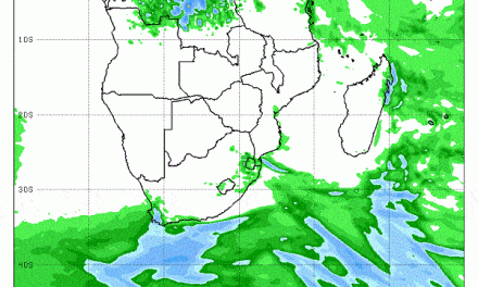
The airflow over the western half was northerly in the north, backing to north-west in the south. It was this airflow at a height between 8000 feet and 25,000 feet that brought in the moisture and the unstable air responsible for the spectacular storms over Swakopmund and the Kuiseb river valley on Monday. By Tuesday, the core of this system covered a very large rectangle from Sukses in the central north to Sandwich Harbour on the coast, across the Namib to the Karasburg district, north to around Stampriet and from there across the interior back to Sukses. By Thursday only a remnant remained over the southern Kalahari but without any reported rain.
Earlier in the week, the South Atlantic high pressure cell was still far out to sea with only its outer rim causing some wind between Oranjemund and Lüderitz. The large distance between the high over South Africa and the next South Atlantic high, provided ample space for the mid-level trough to develop into an effective north south conveyor but the biggest activity again manifested over the South African interior. Still, the brief out-of-season rain over large areas of the Namibian interior was very welcome.
By Thursday the synoptic pattern has reverted to a more conventional winter pattern. The continental high has departed and morphed into the southern Indian high in its customary location south-east of Madagascar, while the South Atlantic high approached the Western Cape. Between the two highs, a prominent depression developed south of Cape Agulhas. While this brought stormy conditions to the southern Cape, it also protected Namibia from severe cold since it siphoned some of the strength of the South Atlantic high away from us. By Friday, fairly normal winter conditions has settled over the entire country.
What’s Coming
The frontal system pushed by the South Atlantic high makes landfall in the Western Cape during Friday spreading rapidly over the Karoo. It comes with a vengeance bringing very cold conditions to the Karas region during the night but because of the location of the high’s core, the cold comes from the south-east. The impact will be limited to the Karas and Hardap regions
For the duration of the weekend, this week’s pattern is repeated with surface high pressure control over South Africa, Zimbabwe and Botswana, and Namibia experiencing a blast of colder air from the east.
By next week, the frontal system is east of the continent with little local impact. However, very similar to this week, another frontal system following a trough, is driven by the next South Atlantic high while lower pressure develops along the coastal plain over the northern Namib. Except for the Kunene region, next week will be substantially colder than this week. It is to be noted there is a significant divergence between three authoritative forecasts regarding minimum temperatures. While they agree on daily maxima, the night divergence is as much as 5°C.


