07 November 2014
![]() What Happened?
What Happened?
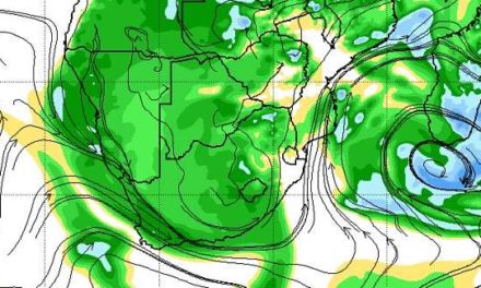
The week started with a prominent low pressure circulation over the ocean in close proximity to Cape Town, about 300 km offshore. Although far south of Namibia, it had an important contribution to local weather conditions as it leaned north and west in the upper air, forming an anti-cyclonic circulation in the alto levels roughly between Oranjemund and Lüderitz. This area of low pressure, isolated from the peri-polar rim where vortices are commonplace, meteorologists refer to as a cut-off low. The cut-off low only lasted a day and was pushed away by the approaching South Atlantic high pressure cell from Monday onwards. That also marked a drop in temperatures for the southern half of the country. For instance, the early morning temperature in Windhoek on Tuesday was only 8oC. As the low pressure area shifted to the east, it gradually relinked with the lower pressure area further south and by Thursday, a fairly pronounced trough has developed covering almost the entire Madagscar with a strong northerly airflow, and a weak vortex some 2000 km south of Madagascar. The cyclonic circulation so far removed from our local scene, nevertheless has a remarkable impact on our own weather in the sense that it helps the high pressure cell move faster along its track to the east. We experience this in the brief duration of the colder conditions in the southern half, and in the very hot conditions in the North. The high pressure cell collapsed just as soon as it made landfall and crossed the sub-continent. With a trough over Madagascar and further south, this process speeds up. Meanwhile, as solar energy increases by the day, the inland plateau of southern Africa, covering South Africa, Namibia, Botswana, Zimbabwe, southern Angola and western Zambia, heats up slowly, leading daily to the creation of a so-called heat-low. This is an area of lower pressure where convection is enhanced driven by solar radiation. By Friday, the core of the South Atlantic high pressure cell has passed Cape Agulhas and has become much weakened reading only about 1020 mB. Airflow returned north to north-east with some anabatic compression over the southern Namib where it was very hot. Very hot conditions also continued over Kavango East and Zambezi. It has been a feature of the season so far that the trough (lower pressure band) only develops at some altitude, usually at around 18,000 feet above sea level.
The trough that moved in late last week, was noticeably lower, at around 13,000 feet, but as the South Atlantic high pressure cell moved across the South, the high pressure control on the surface returned and the cloud base reverted to 18,000 feet. This is not good for rainfall.
Rainfall for the week:
Mpacha airport 1.8; Bagani 6.0; Rundu 21.4; Rundu Airport 25.2; Okongo 0.6; Omaruru 0.1; Grootfontein 0.6; Aranos 0.1; Karasburg 2.9; Katima Mulilo 0.5
Source: Namibia Meteorological Service
What’s Coming?
The weekend starts with the entire country covered by a very broad expanse of lower pressure at about 1012 mB. To the west, the South Atlantic high pressure cell is in its customary position but the core has shifted south compared to a week ago. In the east, the southern Indian high pressure cell reflects normal strength at about 1024 mB. In between lies the broad trough with weak airflow from the north. This is the ideal mix for hot to very hot days, especially over the coastal plain, but also the ideal conditions to advect moisture from Angola. By Sunday, the so-called heat-low over the interior has shifted marginally to the east, now covering Botswana. By Monday the heat-low has become even more pronounced but since its core is still over Botswana, Namibia’s weather is again split into an eastern half and western half. The east, from the Kavango to the Kalahari will be blisteringly hot, while the west, from Kunene to the Spergebiet, will only be hot. By Tuesday, a convergence line develops from Ruacana south-east to Mata Mata. This is where the new approaching South Atlantic high pressure cell meets the anti-cyclonic circulation above the heat-low. Rainfall is indicated east of this convergence line but intensities will be low with 15mm or so being the maximum in isolated thunder showers.