Understanding weather – not predicting 11 October 2013
What happened?
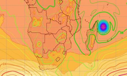
At the best of times, weather charts exhibit considerable complexity. Not only do they cover geograpic areas, the are drawn for several different elevations above sea level, and they progress in time. Yet from this complexity, several times each day, must the current synopses be compiled and presented for a multiple range of users.
Recent events across our skies, an equally broad range from the Angolan and Zambian borders to the Orange River, provided an idea of just how complex even our local weather is.
This Thursday, we had an intrusion of Amazon air with its complex but shallow vortex core south of the continent, a broad middle air advection from both Gulf of Guinea and the Congo drifting round an anticyclonic core above Botswana which is being fed, intermittently, with inflow from the southeast. Four different synoptic charts provide differing projections of this complexity, but each with a level of influence upon our weather.
This build-up was set in motion as the weather patterns closer to home and overhead, saw both an upper core form west of the Kunene while a low level vortex moved and deepened west of Cape Town. This happened while an anticyclonic ridge held sway closer to 45oS, pushing east and feeding the activity to its north.
Our air space was host to daytime heat and the arrival of middle level moisture. This system had considerable depth, visible on synoptic maps over many thousands of feet.
Light scattered showers were recorded from Wednesday which was the expected result.
Twice now have we seen early showers and historically this offers foreboding. True, but with the Pacific Ocean remaining neutral and the ability to tap Congo air, there is a reasonable expectation for a wetter early season.
Some widespread rain occurred on Wednesday and Thursday over the Cunene, Etosha, Central Plateau and the Kalahari but these were mostly only 1mm or less. Windhoek experienced intermittent drops during Wednesday night.
What’s coming?
The overall pattern drifts eastward with a surface ridge bringing a southeasterly inflow during the weekend, becoming northeasterly by Monday.
A renewed core appears above Botswana. Above mid-Atlantic the upper trough reforms similarly and advances as an upper air vortex. With a persistent northerly flow, a cloud and shower potential reappears by mid-week for all but the far northeast, i.e. the Caprivi.
This type of circulation has been noted during past rainfall seasons and persisting for weeks, rather than days. Its orientation and the ability to tap moist air is a positive feature of our 6-month wetter season. The expected showers from next week Wednesday onwards, are unfortunately again of the 1mm range.