Understanding weather – not predicting 13 september 2013
What happened?
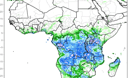
A year ago, our weather patterns were at the mercy of a disturbed equatorial Pacific Ocean, unable to fully match the given criteria of El Nino but the disturbance was sufficient to wobble hemispheric patterns at both surface and upper levels. Observation last year saw promising cloud patterns evolve and move across our skies, not only promising but across the Spring months it produced a little rain in response to the wobbly atmospheric patterns. This was to be the harbinger of a shadowy ENSO-style influence upon not only the Spring but also the entire summer leading to much reduced rainfall across most of the country. The result is the drought which is still with us.
So what about the clouds?
Those early cloud patterns were of the Altocumulus type associated with rainy weather. Their degree of instability boosted convective thrust and, sure enough, the rainy possibility developed. But during these past few days we have seen similar Altocumulus clouds but lacking that broad identifiable instability range. So, despite a broad cloud cover over the Karas Region, only drops were recorded in a few isolated places.
Now why?
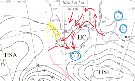
The air flow spreading across Namibia was peripheral to an anticylonic core, so while ferrying some moisture, the turbulent influence was generally absent. The cloud band was able to feed rainy weather away to our southeast over South Africa. This is a quite normal situation for both time of year and the weather pattern involved.
A weak trough line appeared during Wednesday, with some development close to our eastern border where shallow thunderclouds were reported. This trough line gave the few drops across the far south.
The anticyclone aloft kept warmer conditions in place with mid-30 maxima prevalent across the North. Cold invasions were unable to thrust northward.
A normal style Spring seems to have set in.
What’s coming?
The cold airmass identifiable at the 850hPa level south and west of Cape Town moves with the predominant westerly flow at that level and aloft, taking away a potential influence by weekend.
Thrusting ridges bring high pressure cells across the far south, quickly reforming as effective cores to the southeast of the sub-continent: ensuring our easterly wind orientation well into the new week. The cloud band flow is expected to weaken, while the upper flows keep to a more westerly orientation, i.e. a zonal flow typical of an “in-between season” synoptic pattern: less cold but not enough overall heat to develop thunderclouds. Overall, it is a promising neutral stage at this time of year!
The important but distant Pacific remains within its neutral range. It is cooler west of the dateline but markedly warmer to its west. Weather scientists maintain their Enso Neutral description of Pacific conditions. The Multivariate ENSO index however, has just recorded the third month in a row of negative values which may be an early indication of improved, or at least normal rainfall during the period December to March.