Understanding Weather – not predicting – 24 May 2013
What happened?
The departure from one pattern to a more favourable one is now an established feature on our synoptic charts for both the surface and throughout the upper air. The reversion to more normal patterns coincided with the approach of a very promising front which was expected to develop into a cut-off vortex and stagnate for a day or two. This system collapsed but gave rise to an equally well-marked pattern which also brought about the collapse of the extensive, dominant upper air anticyclonic presence which had held sway for the past few months.
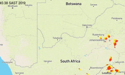
As this new vortex pattern evolved it began the advection of moist air from the fringes of the tropical air persisting west of the Congo estuary. Because this pattern persisted, this advection also continued, intensifying as its moisture depth increased from a few hundred feet to some 2 or 3 thousand feet. This persistence was rewarded as local convergence lines appeared with comparable thundery cloud patterns identified both by satellite imagery and personal observation across much of Namibia.
Shower potential was also achieved and, for a broad area of activity, thundery showers were recorded. Measures up to some 20mms have been noted from places as diverse as the Omaruru district and east of Otjiwarongo to the Okavango valley to the Gobabis district. In between, there are numerous reports of a few drops to some few millimetres.
The significance is that, due to absence of colder temperatures, these showers have given life to the existing veld in several places.. Further significance is that the decaying anticylonic control enabled Cumulonimbus development to mature.
May is well down the list where rainfall is concerned. Occasions of summer-type rains are few and far between with only limited values on record. This may look promising, but the actual measure is scant; the value to the rangeland and the environment offers values which only the environment appreciates.
As matters stand, this past week saw the departure from one unwelcome pattern to the more normal, generally favourable pattern to which we have become accustomed. The forthcoming prospects have become far more amenable than they were just a couple of weeks ago.
What’s coming?
Although synoptics for the South Atlantic are dominated by low pressure cores persisting throughout the lower levels with a low level anticyclonic core present to the south, the ability to disturb the generally northerly flow across Namibia is absent.
Frontal advance north of the Orange is, at this stage, also limited. This flow supports occasional cloud development from central Namibia southward. Daytime temperatures into the upper 20’s, touching the 30’s, persist. Overnight chill is equally limited: mild conditions for the time of year persist. The “oosweer” potential is restricted by this northerly wind orientation. During the weekend, a substantial trough approaches the Western Cape. This system has the potential to push as far north as the Oranjemund, Lüderitz, Rosh Pinah triangle by Sunday.