Understanding Weather – not predicting – 10 May 2013
What happened?
With the gradual transition from autumn to winter in the southern hemisphere, a more typcial (expected) weather pattern is slowly taking hold.
Whereas the synoptic patterns of the past two months were more reminiscent of winter than of summer, the synoptics are now settling into a typical early winter pattern. This presented itself last weekend when the first true vestiges of the approaching winter were heralded by a fresh south-easterly that gradually backed to an easterly wind during the course of the weekend but eventually subsiding to a steady north-easterly airflow.
As the wind direction swung around, oosweer again became a prominent feature of the coastline north of Swakopmund, but this also dissipated during the course of the week, with conditions returning to an early winter pattern. On Sunday and Monday, day temperatures exceeded 30oC in along the coastal plains north of the Ugab River returning to normal by Tuesday. The night temperatures over the inland plateau remained above 10oC from Monday to Thursday with day temperatures hovering somewhere between 24 degrees and 28 degrees. All in all a fairly normal situation for autumn.
An interesting development just outside our territory occurred earlier in the week just north of the Angolan border. A slow anti-cyclonic circulation over southern Angola lead to north-westerly winds over the north western third of Namibia, advecting some moisture ahead of a trough that was then still over the Atlantic. This produced a restricted band of cloud over the eastern parts of Owamboland and over the Okavango region, but the ever-dominant high pressure cell in the upper air prevented precipitation.
By Thursday the approaching trough from the west re-instated the coast’s normal south-westerly winds, bringing in unseasonally strong fog patches to Swakopmund and Walvis Bay as well as the stretches of coastline further south.
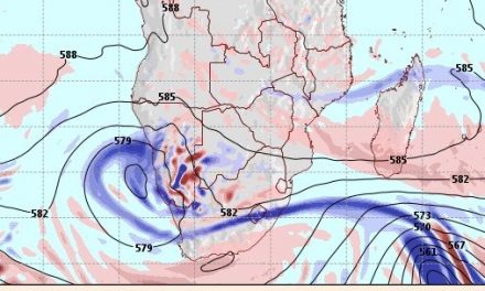
What’s coming?
The Atlantic trough has a marked effect on the surface and in the middle layers up to about 20,000 feet. Airflow ahead of this trough runs from the north west to the south east, i.e. from the Kaokoveld to the Kalahari but its impact on local weather is limited other than preventing very cold nights. Friday morning will be cool but this will rapidly turn warmer as the system that advects the colder air passes to the east.
Behind the trough is the standard South Atlantic high pressure cell moving eastward and driving the more unstable trough ahead of it, but as it crosses the continent, it wavers and slips around the Cape with little local influence. The high pressure cell is of limited intensity not exceeding 1020 millibar on the surface. As it moves to the east, the wind direction will change from south-westerly to south-easterly, and by next week, swing around to an eastwind veering to the north as the high pressure system departs the sub-continent.
In general, airflow on the surface should be zonal (west to east, and then east to west) restricting the impact of the colder air from the south.