Understanding Weather – not predicting – 08 February 2013
What happened?
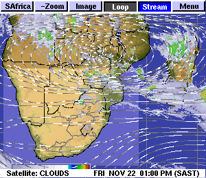
February’s rainfall prospects remain influenced and restricted by an upper air pattern which varies considerably from the expected template for this time of year.
Our geography places us within the range of the sub-Tropical High Pressure belt, so the expectation of drier air, at least intermittently, is quite reasonable. During the summer months though, the combination of daytime heat coupled with an ability to tap the adjacent moist air mass to our north does much to pressure the upper levels of this dry air to relax its grip, enabling rainy weather patterns to develop.
Currently, these links are tenuous.
Each day the quite favourable surface pattern appears: anticyclonic cores progress south of the Cape, broadening with their arrival off the southeastern sub-continent, ensuring a moist inflow frequently as deep as the 850hPa level, some 5000 feet above sea level. Daytime heat ensures the surface low-pressure area forms above the western subcontinent.
As this airflow invades, its moisture assists convection, clouds form and further activity leads to thunderstorm development. Further activity requires a favourable pattern aloft in what are called the middle layers. Such a pattern is identified by a layer of air within which there is instability, i.e. vertical movement within the layer. In such air, convection becomes more volatile and thundercloud development is imminent.
Yet, as we see daily, this range of vertical development is restricted. Cloud bases support quite solid vertical development but, as the convection penetrates the lower levels of the unfavourable airmass, the convection thins. Local turrets may emerge but widespread rain does not materialise.
On a broader scale, covering Namibia and the adjacent sub-continent, this limiting synopsis holds the upper hand regarding our daily weather conditions.
Wind-flow patterns, both recorded and predicted, describe motion aloft from directions unlikely to advect moisture in any quantity. Moist air has the potential to assist instability, so when moisture is limited, generally more stable conditions ensue meaning only small amounts of rain. These same wind-flow patterns revolve around intermittent low pressure cores which have been present during the past weeks above Zambia, their trough activity extending south and east across the neighbouring sub-continent. Potential for a westward drift or extension fails to emerge.
What’s coming?
Lower level anticyclonic cores continue tracking along the 40oS path, in contest with the static upper layers holding sway to our west over the Atlantic Ocean. These anticyclonic cores maintain flows from the southeast across the subcontinent and over almost the entire Namibia, preventing penetration from moist air over southern Angola and western Zambia.
A quick moving middle layer vortex appears over the weekend, drawing some air into our south, but with little northerly input, the showery prospects appear limited.
A moist extension covers the Caprivi this weekend: any westward drift is diverted to the north-west where isolated showers may surprise both in duration and intensity.
Isolated showers of limited intensity remain the most probable expectation for the eastern half of Namibia.