Climate Change? From What?
While people at various international meetings gather to debate what should be done, let alone when and how, the world of weather carries on relentlessly. From the practical side we first need to consider what we are talking about? Where is square one and from what are we changing?
Global geography has been set into a climate template, developed to assist in the design and building of computer models used mostly for analysis and forecasting. While developing these models, the concept of change has been included but it is captured along static, predictive lines. When the rate of change itself changes, or the horizon either widens or contracts, the model fails to compensate for the change in change.
Adjusting the models to compensate for the perceived deviation, results in forbidding forecasts being presented. They seem to overlook the weather (day-today) and climate (season-to-season) matching our local and regional experience of the first decade of the new millennium.
Square one sees the two hemispheres and the four climate divisions of Frigid, Tepid, Arid and Torrid; broader description expands to Frozen, Temperate, Dry and Tropical. These are based on temperature first and foremost. Temperature variation, differing noticeably from mean ranges, affects crops, sowing, growing to harvesting, with potentially catastrophic effect, particularly across the Tepid zones where temperature deviation from normal ranges is most noticeable.
Temperature variation is also common in the Torrid zones but since they are invariable warm to hot, and moist, the impact is limited.
Arid is identified by the broadest ranges of temperature and most importantly, rainfall. World-wide, Arid climates are not food producers. The deserts of the world are to be found within this climate belt. However, in southern Africa, Namibia in particular, there is a slight divergence.
By Arid standards, Namibia is favourably distant from the deserts associated with the Arid belt, which has hyper-aridity as the regular base. Southern Africa’s most severe is the Steppe climate of the Karoo; this is ameliorated with winter rainfall consistency. The Namib, by hyper-arid standards, boasts a very limited but identifiable rainfall expectation: coastal fog adds another moisture component unavailable to inland deserts. Further inland the Kalahari thirst-land, far removed from true desert, is bisected by an annual isohyet in excess of 300mm. True desert rainfall values are less than 100mm. Desert is described as a place where trees do not grow. Inland from the Namib, the sub-continent is actively, agriculturally, productive.
So what and why do we change to?
Global warming, induced by mankind’s activities rather than Natures natural fluctuations, provides an identified expansion of the Torrid Zone. It is therefore not unreasonable to expect the worlds warmest will react first to increased global warmth.
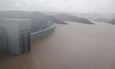
For the past few seasons, American climatological analysis identifies the advance of the Inter Tropical Front (ITF) a full 2 degrees further north; the normal position is between 17 to 18o North, penetrating the Sahel, to a persistent (some 14 or so weeks duration) 20o latitude. Our side of the Equator has brought an advance of the Congo air mass (Torrid air and attendant tropical rains) to our airspace more or less consistently during the new millennium, season 2007 being the one exception. Similar extensions reported from both South America and Australia make headlines due to unusual floods. No such disasters have occurred in Namibia, but the availability of the oshana beds as cropping land has been limited by recurrent inflows and persistent presence of water within these numerous tributaries of the unique Cuvelai Delta. The remarkable rains of season 2011 (January to April) came close to the disaster potential: on a widespread basis, these rains, both daily and monthly detail, bettered existing extremes. Windhoek’s road networks where 1934 flood levels are noted, the 2011 floodwaters came close. The 1934 season was a combination of the more recently identified Benguela’s El Nino and the Pacific La Nina. This coupling also peaked in the 1974 and 1976 seasons and again in 2006. 2011 was a La Nina event year, pure and simple.
During a Benguela El Nino, warm waters flow as far south as the Orange River Estuary. It recurs approximately mid decade. Whether or not there could be increased recurrence due to globally enhanced warming is at this stage uncertain.
The Torrid advance has forced the sub-Tropical High Pressure belt not only to expand (some 40oN and S) but also to elongate so to provide frequent ridges into and across the Tepid zone to tap fringes of the Frigid air mass and advance these towards the equator.
The frequent recurrence of stormy weather across the northern continents has borne this out. Our southern hemisphere lacks land masses so far south to report such occasions.
By text book standards we are now a space or two away from the norm; a reversion would seem like gravity running up-hill. The dry excesses promised by the computer models compare badly with our practical weather and climate experience. It is conceivable that our unique geography has escaped the dedicated efforts of the model compilers.


