Understanding Weather – not predicting – 02 November 2012
What happened?
Sadly Sandy took the weather headlines but gave two pertinent practical pointers regarding Namibia. As a source of energy, wind has long had its protagonists. Our experience stems from a coastline where, with but brief exception, consistent flow predominates on a 24/7 basis without extremes and their damaging potential. While extremes were in evidence though, the power potential also was equally evident. The other positive is solar: with some 3000 hours each year across over 95% of the country, this sets us apart. Coupled with this we have an agriculturally provident land area. Not everybody living beneath the Sub-Tropical High Pressure Belt can match our situation!
Global Warming has established itself with no uncertainty. Sea temperature has also reflected this. The equatorial Pacific reflects the disarray also, while warmer stretches appear variously around the world. Vital temperature benchmarks are breached with new records set almost every year.
Maritime tropical storms require a 29oC base from which to form. Our concern is the not-so-distant Mozambique Channel. Tropical Cyclones do have a history of intrusion west of Madagascar, more surely when the Mauritius anticyclone stabilizes so steering such storms further westward. The vortex provides a vast ring of convection which supplies an outward, surrounding ring of air beneath which convection is suppressed and dry weather prevails. The risk of this weather prevailing increases accordingly.
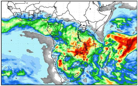
This last week our weather provided an example of this. The southward disturbances came and went with a reviving air flow from the east enhancing mid-level, moister, airflow. Cloud development was the most substantial yet of the new season. Occasional thundery outbreaks were subsequently recorded. The mix of airflows kept unstable, moister air active across northern Namibia from the escarpment eastward. Departure eastward was delayed until midweek. Being a rather shallow level of disturbance, the occasional showers were of limited intensity. October is really no more than a month of occasional showers. In that regard, it was a very normal October.
October showers typically vary from drops to only slight falls. Even the Caprivi is within such limits.
The daily heat-low lay more eastward, overnight cooling due to south to southeasterly flows affected the central to southern regions. Daytime heat saw veld-fire occurrence as a frequent risk.
What’s coming?
A major surface anticyclone moves round the Cape, establishing an easterly flow which backs to northerly by weekend coupling with a shallow northerly flow up to the 700hPa level. Showers within a narrow band across central Namibia are likely, moving eastward during Sunday. Some persistence prevails in the Okavango catchment and eastward.
Moister conditions return only by mid-week. Again, frontal activity is restricted to beyond our south. Some showers in the north along the Angolan border up to Etosha but mainly sunny elsewhere.