The Week’s Weather 06 January 2017
The first major intrusion from Angola deep into the Namibian interior happened over the past six days. A well-developed low level trough ran from the Kunene river across the North, north-east, the central high ground, and into the Kalahari along the Botswana and South African borders.
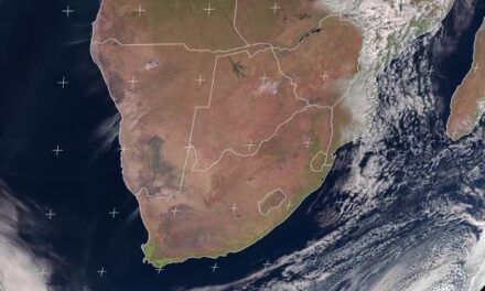
But the South Atlantic high pressure cell continued to dominate surface conditions as evidenced by the deep inland penetration of the fog belt on at least three occasions. However, the cell was relatively weak with a core reading of 1020 mB so the on-land impact was limited to the western half of Namibia. Where the high’s outer rim encountered the low-level trough, a very wide convergence zone formed with a well-demarcated convergence line running more or less from Okongo in the north, past Windhoek on the eastern side, and down into the Hardap and Karas regions. It was also noticeable that where the cloud base west of the convergence line was around 18,000 feet, east of the convergence line, the lower cloud surface rolled in at about 10,000 feet elevation.
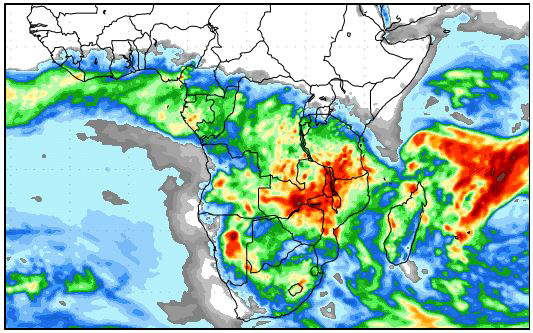
The daily rainfall figures published by the Namibia Meteorological Service illustrate best the importance of surface locale relative to the convergence line. Several places from Owambo, through the interior into the Kalahari registered daily falls in excess of 50mm. Most araes east of the convergence line registered a comfortable 25mm or more. But only 100 km furhter west, i.e. west of the convergence line, only sporadic falls of 10mm or less occurred.
As the new year gathered speed, so did the northward extension of the South Atlantic high. This roughly translated into a westerly to southerly wind direction on the surface over Namibia’s western half, while the eastern half saw the wind coming from north-east to north. Towards the end of the week, a strong cyclonic surface circulation formed over south-eastern Angola. Following the general direction of the airflow from north to south, the core of this circulation moved to the Ganzi district in Botswana. This created a unique weather pattern with a cyclonic (low pressure) circulation below 18,000 feet and just the opposite in the higher levels.
Being west of this low pressure core, the western half of Namibia had several moisture intrusions, but from the south-east, not from the north-east as would be expected. Still, during the week the highest rainfall was recorded in a broad band from south-eastern Angola, southward hugging the Namibia Botswana border, as the core of the cyclonic circulation migrated from north to south.
Although the rain season has begun with stops and starts, it has not yet blossomed into full potential. The biggest change over the continent from before Christmas up to this week, is the strengthening Inter-Tropical Convergence Zone over East Africa. Whereas the ITCZ was well-developed over Angola and the DRC, it lacked coherence over northern Mozambique, Tanzania and southern Kenya. That has changed dramatically over the past two weeks. A fragmented atmosphere over eastern Africa prevented to a large extent the transport of moisture from the Indian Ocean into central Africa. With the ITCZ now firmly established and visible over eastern Africa, the conveyor route around the northern tip of Madagascar has been cleared, opening the channel for moisture to move into central Africa, and from there into Angola and Namibia.
What’s Coming
A weak South Atlantic high pressure cell remains in situ offshore south-western Africa. The core is not well defined but the outer rim at 1016 mB covers about three quarter of the Atlantic between Africa and South America. This is an indication that the high will remain the dominant surface component for the next week.
A significant intrusion is expected in the middle and upper layers from Zambia and from Angola. While all rain outlooks expect the weekend and next week to be cloudy, the interplay between high on the surface and a low pressure system higher up, will continue to produce localised heavy falls over the northern and north-eastern quadrants, and further southward along the Botswana border and into the Karasburg district.
If the cyclonic circulation persists over Botswana, the Karas and Hardap regions may receive some unexpectedly high falls, but still only scattered. Landregen is not yet on the charts, although conditions are turning more positive by the week.