Understanding Weather – not predicting – 22 June 2012
What happened?
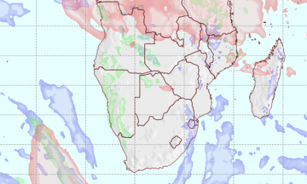
As the week progressed, the daily synoptic pattern grew in complexity.
The persistent turbulence as presented by the upper air charts reflecting the contrasting airflows predicted the formation of an elongated upper trough west of the sub-continent over the Atlantic with a tenuous link to the similar trough departing just south of the continent. This new cut-off vortex developed in intensity, extending throughout the troposphere to above the 40000 foot (above 200hPa) range. Such depth does much to provide an air circulation of notable significance. Some tropical air were fed across the interior but very high up.
By Monday evening, associated cloud patterns were forming and local showers were noted.
The lower levels, sea-level to some 5000 feet, were reacting to the squeeze between the western edges of the departing cold front trough and the anticyclonic ridge thrusting its way across the South but also around the vortex core which had, in the past few days, become separated from its original parent vortex away to the south. This matches the description of a complex low pressure system.
It fits the given situation here and, when coupled with the adjacent upper air complexity, only serves to test the imagination with regard to the radically turbulent scene holding sway across a considerable area above the western sub-continent and the adjacent ocean.
While the direct cause for this complexity may be difficult to assess, it does bear the hallmarks closely linked to the overall shift of airmass presence and the matching ability for these departures from the norm to appear on the same weather stage, virtually side by side: evidencing the impacts brought about by the shift or change of climate zones and their patterns.
For our south-east, from the Windhoek area southward, widespread to general shower activity was there was recorded. Some rainfall measures over both the pre-Namib and the Kalahari exceeded 20mm.
With the upper air activity and subsequent vertical mobility, the interior recorded milder days but in the South, zero degrees in the morning was the norm.
What’s coming?
While the current pattern departs during Friday, a new upper vortex develops by weekend again west of the Cape. Weather activity may be confined south of the Orange, but active weather can develop within the cold under-cutting currents on its western side and the tropical presence on its northern side. Very light rain may be encountered in southern Namibia.
Southerly low level inflows arrive by Saturday, with a wind flow switch bringing warmer days in the new week ahead the vortex and cold front which appears by mid-week. Early in the week, cooler air penetrates from the east into the Kavango area at least while our north remains comparatively warm. Over night frost looms for the southern parts. The expected weather divides itself into a northern half and southern half pattern – warmer and colder.