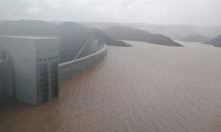
It is only a small stream but it brings much hope
Western Owamboland has five major drainage lines all running from southern Angola to a common collector point, colloquially known as Lake Oponoono. Collectively this system is known as the Cuvelai drainage system although it has to be pointed out that the name Cuvelai also applies to certain of the individual lines, and to a large area in adjacent Angola.
The eastern-most line starts in the area west of Helao Nafidi, i.e. the western corner of Ohangwena. From there it runs due south, almost touching modern Ongwediva, on its southward journey to the lake. The other four all start in Angola and enter Namibia at regular intervals along the Namibia Angola border. These four run through the northern half of Omusati and through Oshana, the latter getting its name from the pans.
These five lines stretch like veins across the otherwise flat landscape, in many areas the only indication of a very minor disturbance in the generally level topography. In other areas, the terrain is so flat, it is very difficult to discern where the actual main drainage line runs, it only becomes visible when the Efundja comes when it can be traced as a series of small interconnected pans or Oshanas (eeshana). This happens by late February when the major rainfall season in southern Angola is far progressed. However, the Eeshana often collect their own water towards the end of the year, from local rainfall depending on the season.
It is an interesting fact that the Cuvelai drainage system and the Kunene river are not actually connected. Although in close proximity, the Cuvelai catchment area is separated from the river by a slight rise in the landscape. The Kunene gets its biggest inflow from the Angolan highland some 400 km farther north, while the Cuvelai depends on local rainfall in the bottom 200 km of southern Angola.
By April, the water in the Cuvelai system is at its highest, in some areas covering many hundreds of square kilometres of eeshana ranging in size from a fishpond to about two soccer fields. This systems is the ancient lifeblood of the extensive settlements that today form the traditional communities of the so-called Four O regions.
In an area where extractable groundwater is usually bitter above the shale or too deep to pump economically, the Cuvelai system is of cardinal importance. Its ditches and pans provide a natural conveyor for seasonal water and much of the life in Owamboland would not have existed were it nor for the regularity and dependability of the Efundja.
Then a year like this hits, and the entire area is gripped in drought manifesting itself in a lack of grazing, and empty eeshana. This is a calamity for the communities and for their herds.
I was informed this week by a colleague that the western-most line which has been rehabiltated in some areas, is running. This is a major event and detail of the running water came in a torrent of joyous exclamations. The water follows the western line, sometimes called the Etaka, but I have to point out that these lines have many different names in the areas they traverse, so it is advisable always to make sure exactly which line a community or village is referring to when a certain name is used.
This line has been modified in many areas, supplemented by canals to make sure the water flows more or less in the direction required. Today, this system is actively managed and the water can be opened or blocked according to local needs. The waterflow exploits the natural drainage line helped along in some areas by man-made canals. In some of the more densely populated areas, culverts have been built across the ditches to assist motorised traffic when the line is full of water. This is very apparent on the Oshakati Ongandjera road where no less than three of the major lines are traversed before the road reaches its royal destination.
I am aware of several studies on the Cuvelai drainage system. These all point to one thing – Owamboland’s natural water drainage lines can serve the western regions as water carriers, taking surface water throughout the year to areas that are often dry. It serves as nature’s systems of making water available to livestock all year round, relieving much of the pressure when cattle and smallstock have to cover large distances, not only for grazing, but also for water.
The good news of the flowing Etaka, I view as a positive prelude to the Ongwediva Annual Trade Fair. I hope this also signals a better second half of 2016.


