Weather 25 August 2016
What Happened
The weather is settling into a predictive late winter pattern showing a mostly neutral synoptic progression.
The cold spell early in the week was not unexpected but brief. As is typical, it was the result of the South Atlantic high pushing over the continent, having made landfall at about Oranjemund, and then slowly, over a three-day period, spread east across the Karas region and then north up the Botswana border, and from there back over the interior.
It brought night temperatures down to almost zero in the Karasburg, Keetmanshoop, Aminuis and Gobabis districts but by Wednesday, the high has departed and taken the cold air with it.
The number of sunshine hours per day now exceeds eleven and a half hours, bringing a powerful mix to the local weather scene. Since the high pressure cell always migrate from west to east, the distance the cold travels over land increases, the farther east the high’s core is. This provides ample time for solar irradiation to do its work, and by the time the cold air reaches Namibia from the east, having crossed Botswana, Zimbabwe and Mozambique, it is pleasantly warm.
Toward the end of the week, the synoptic pattern was very typical mid-winter with the South Atlantic high splitting from the continental high and the latter departing to Madagascar, morphing into the next southern Indian high. The high’s impact was limited mostly to the area south of the Orange river, so its local influence was short. In fact, only the outer rim of the high at 1020mB crossed into Namibia, hence the very brief, light cold spell.
A cold front trailing just behind the leading rim of the South Atlantic high passed the Cape during the week, but was deflected to the south by the weak vortex at its southern extremity. This has happened several times during this winter when a major cold front was blocked by the high pressure cell to its north, and simultaneously weakened by the action of the vortex at its southern end. It was only in the middle of July that the first cold spell intruded Namibian territory, indicating the persistence and the ability of the high to block cold intrusions from the south.
By the end of this week, the high has shifted far enough east to allow a significant low-pressure system to develop along the Namibian coastal plain. As usual, this system originates over Angola as an extension of the tropical low pressure belt. It typically enters Namibia near the Kunene mouth from where it migrates south, hugging the coastal plain as it develops first to the central Namib and then later to the southern Namib. It creates a pressure differential between the interior and the coastal plain, leading to windy, often very hot conditions as air descends from the central plateau over the escarpment and down onto the coastal plain. The effect this week, however, was rather subdued, first because of the presence of the migrating high in the south, and second, because of the small difference in pressure between the interior and the coastal plain.
What’s Coming
By Friday, the low pressure system in the west has reached all the way down to Cape Town. In the east, a weak continental high resides over the South African highveld. The pressure differential is only some two millibar so conditions should remain mostly quiet and clear during the weekend. The only exception is the coastal plain where lower pressures will remain in place.
The bigger picture is setting itself up for an early summer pattern. The first occurrences of the typical yin yan pattern over Namibia is beginning to appear, but it is still weak.
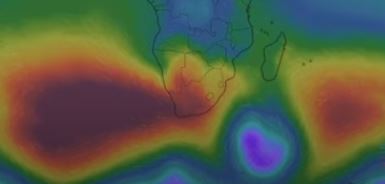
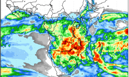
High pressure control in the upper air is still very evident with enhanced zonal flow from west to east at or above 18,000 feet. This means that whatever moisture is brought in by the mid-level trough over the coastal plain, will be displaced quickly to the east. At this point, conditions are neutral being neither positive nor negative for early rain.


