Weather 24 June 2016

What Happened
As far as the location of the high pressure cells is concerned, this week’s synoptic progression displays all the elements of a typical mid-winter pattern. The eastern part of the sub-continent was under strong high pressure control, spilling over into Botswana, and from there forming a clear, well-demarcated ridge across the border into the Omaheke region. The airflow was predominantly from the east, backing to north-east later in the week. On the coastal plain a weak low pressure system, originating from Angola, was present for the whole week.
The core of the high pressure cell remained more or less in position south of Madagascar, only shifting slowly to the east. Its outer rim continued its presence over southern Africa, hence the typical sunny days and cold nights.
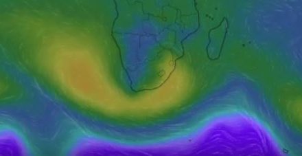
The anomaly, however, is found in the region south of the high pressure belt. At around 50°S, a succession of very strong vortices appeared on the synoptic map by Tuesday and remained there until the end of the week. The cores of these depressions rotate at around 60°S, just outside the antarctic circle, with barometric readings as low as 970 mB. This is indeed extreme low pressure meaning that very stormy, unstable conditions are prevalent in the southern ocean. But it is not only at those southern latitudes that they have an effect, they have a major, observable impact on the high pressure cells north of them.
The southern vortices act like massive suction pumps that deplete the high pressure cell of some of its strength. This was readily observed this week by the intensity of the high over South Africa (1032 mB), but with only a limited impact over Namibia. Normally one would expect such an intense high to bring sub-zero temperatures to the Karas region and to the Omaheke region along the Botswana border. But with such strong low pressures in the southern ocean, the airflow on its trailing (western) rim is from the north, dispelling much of the coldest air that comes from the south. So, while the high is still very much in control over the eastern sub-continent, its own circulation creates the conditions over Namibia to advect warmer air from the north. This is especially the case in the mid-levels, between 15,000 and 30,000 feet, The further west and north, the more prominent this phenomenon which is the reason why the Kunene region tends to develop lower barometric pressures. The added effect of the strong vortices, almost 3000 km further south, helps to shield Namibia from the intense mid-winter cold.
What’s Coming
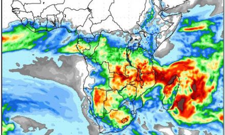
On the surface the entire sub-continent remains under high pressure control with the 1016 mB isobar cutting across northern Angola, the central DRC and through northern Tanzania. It is safe to say that southern Africa, south of the equator is under mid-winter high pressure control and will remain so for the next month, despite the persistent troughs developing in the mid levels.
At the beginning of the weekend, the continental high pressure cell has shifted slightly, the core lying some distance south-east of Madagascar. It is still very strong with a core reading of 1032 mB, thus it will continue to influence conditions over southern Africa.
By Sunday the next approaching South Atlantic high is still some 2000 km out to sea but it is driving a major frontal system ahead of it. This cold front reaches the Cape by Sunday evening.
Monday will see a drop in temperatures over the Karas Region, with the cold coming from the south. This effect will be felt as far north as Windhoek.
However, by Tuesday the high, as it moves over the continent, becomes weaker, losing much of its intensity and cold. The same event as this week occurs next week when the strong southern vortex south of the high’s leading rim, siphons away its strength creating a not-insignificant mid-level trough that runs from Angola across Namibia and into South Africa.
Again, despite the cold night conditions, frost is not indicated and is unlikely to occur, even along the Botswana border in the Omaheke Region.


