


Weather 24 March 2016

What Happened
Not only is 21 March Independence, it is also the equinox when the day and night are of equal length, more or less, depending on how far north or south you are of the Tropic of Capricorn that runs across Namibia some 70 km south of Rehoboth.
At this time of the year, the sun is directly over the equator indicating that the amount of solar energy that reaches the earth’s surface further south or north, is already diminished since it enters the atmosphere at an angle. As we continue through autumn that angle grows every day, so the available energy become less and less. At the same time, as the days shorten, the duration of solar energy also decreases. The combination of these two factors is simple physics but they do take us rapidly to mid-winter in June.
Around the time of the equinox, the number of sunshine hours is more or less balanced for a short period, by the number of night (dark) hours. This changes, on average, at the rate of about a minute a day. The result is that solar irradiation by day is balanced by terrestrial radiation by night. In real weather, it typically leads to conditions displaying both summer and winter characteristics. It also often happens that summer patterns are rapidly displaced by winter patterns, and then, just as rapidly, swing back again to a summer pattern.
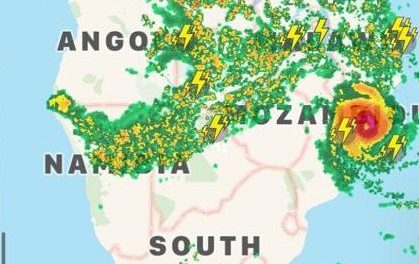
This is exactly how the weather panned out this week. The first portends of an approaching cold front arrived on Monday when the south, south-east and large areas of the central high ground awoke to a rather chilly morning. But 12 hours of sunshine is not to be disregarded so the day temperatures tended to revert to around 30oC in the late afternoon. Obviously, in the south it was less while in the north, somewhat higher. For the whole week, morning temperatures were down, the skies were clear, and except for the Zambezi, rainfall was gone.
The bigger synoptic picture immediately shows the important role of the South Atlantic high pressure cell, the southern Indian high pressure cell, and the very delicate interaction where the outer rims of these two mega-systems meet over southern Africa. The South Atlantic high was the dominant cell for this week. It was in its customary position with its outer rim, the 1016 mB isobar just touching the Karas region, and gradually migrating across South Africa towards the Mozambican channel. Its core read a respectable 1028 mB earlier in the week and then subsiding somewhat to 1024 mB by the end of the week. Slightly less in intensity but still a strong cell. The core also covered a very large surface areas, almost 3000 km across, much bigger than the typical South Atlantic high.
On the other side of the continent, the southern Indian high was weaker, the core was markedly smaller, and it was displaced to the south by some 600 km.
This shows that the impact of the South Atlantic high will be greater than that of the southern Indian high. This leads to typical Namibian weather, sunny and dry.
What’s Coming
The cold front ahead of the South Atlantic high has passed the Mozambican Channel. The high slips around Cape Agulhas forming an elongated high pressure area covering some 5000 km in extent, from west of the sub-continent to east of Madagascar. It moves slowly towards the east remaining in situ during this Thursday but then it splits into two – a dominant South Atlantic high and a weaker secondary cell immediately south of Madagascar.
It is at this point that forecasts diverge presenting two rather opposing views of how the weather will develop further after Friday.
Scenario one sees a strong vortex develop south of Cape Agulhas between the departing high and the approaching high with a strong trough forming in the mid-levels from southern Angola across Namibia and Botswana, into the South African interior. This trough is amplified by the low pressure south of the continent, and may lead to cloudiness over northern and eastern Namibia.
Scenario two sees both high pressure cells exerting a magnified influence over the entire sub-continent. Although a trough develops in the upper levels along the convergence line, its impact on the surface is minimal. The skies will remain mostly clear with zero rain. It is only by next week Wednesday that conditions are expected to return to a summer pattern.


