Weather 19 December 2014
![]() What’s Happened
What’s Happened
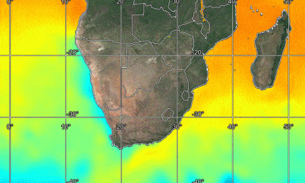
The battle between north and south continues. The week began with the South Atlantic high pressure cell in its somewhat displaced position with its core about 2000 km west-south-west of Walvis Bay. On the opposite side of the continent, a weak Southern Indian high pressure cell lay some 3000 km east-south-east of Madagascar, and over the southern African interior, a very dominant anti-cyclonic mid-level circulation persisted.
The only anomaly is the low pressure area immediately south of Madagascar. These events may seem to be very far removed from our shores but they are the determinants of local Namibian weather. For the past six weeks, the South Atlantic high has been displaced towards the north by as much as 1000km. The effect is that rainfall over the south-western half of the country has been inhibited. The South Atlantic high is not very strong, measuring only about 1020 mB at its core, but its northward displacement leads to unseasonally low night temperatures, and to clear skies as far north as Benguela in Angola. It also causes cold, foggy conditions at our coastline, with strong southerly winds along the southern half, and weaker westerly to north-westerly winds from Swakopmund north up to Aiona in Angola. This northward displacement may or may not be the result of anomalously warmer water in the very far southern Atlantic. The anti-cyclonic circulation over the interior has gathered some strength and shifted its core from the Angola Zambia border to the eastern part of Zimbabwe. Yet, it is still too far north by some 600km to have any material impact on local rainfall in Namibia. These poor conditions are further exacerbated by the persistent weak low pressure area south of Madagascar, weakening the effect of the high pressure engine as it shifts across the sub-continent from west to east. The balance of this stance, is that rainfall prospects are not very positive. A layered atmosphere with high pressure control on the surface up to about 15,000 feet, low pressure control in the mid-levels (15,000 to 30,000), and a weak but persistent high pressure control in the upper levels above 30,000 feet, is the hallmark of the local weather for the past month. This situation will remain more or less unchanged unless or until there is a significant shift in one of the three anchor elements. Either the South Atlantic high must shift south, or the southern Indian high must become stronger and closer to Madagascar, or the anti-cyclonic circulation over the interior must shift its core to the confluence of the Sashi and the Limpopo. Only then will conditions improve.
Rainfall over the past two weeks
10 December
Ruacana 8
12 December
Ruacana 30
15 December
Rundu 11.3; Gobabis 1.0; Maltahöhe 1.0; Okahao 0.2;
Tsumeb 0.1; Windhoek 0.2;
16 December
Mpacha Airport 1.8; Katima Mulilo 1.0;
Rundu Airport 0.2; Leonardville district 40;
17 December
Mpacha Airport 14.2; Gobabis 0.8;
Hosea Kutako I.A 0.4; Rehoboth 0.2; Katima Mulilo 0.1;
18 December
Mpacha Airport 2.4; Katima Mulilo 0.6; Bagani 0.1;
Outapi 0.1;
Sources: Namibia Meteorolgical Service, Namwater, and
local farmers.
What’s Coming
The South Atlantic high pressure cell stays static. The low pressure area south of Madagascar increases slightly in intensity but not enough to form a vortex, still it debilitates the north, south, north airflow required in the Mozambican channel to drive moisture across eastern Africa into central Africa into Angola, and eventually into Namibia. A curve running more or less from Outapi south to Otjiwarongo and from there to Gobabis, marks the convergence line, most visible in the mid-levels. This leads to a weak trough forming from south-western Angola to southern Botswana. The weekend sees a clear and hot western and south-western half of Namibia. Wind at Oranjemund will be fresh from the south and south-easterly at Lüderitz. Further north along the coast, the dominant airflow will be from the west continuing the cold and wet conditions. Along the northern coast, the wind will be moderate from the north-west. Rainfall is indicated only for the parts east and north-east of the convergence line but will be isolated or scattered, and limited in extent and intensity. The interior of Botswana remains very hot affecting conditions in the bordering areas of Namibia. Early next week, rainfall conditions improve marginally but overall it remains more an outcome of luck than of a tropical low pressure system.